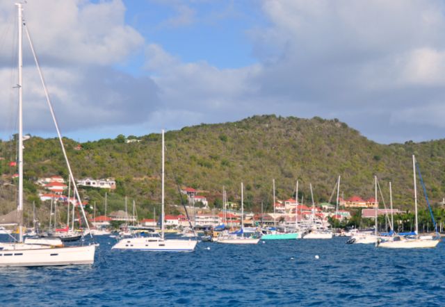
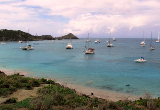
St. Barths: On February 10 we were cleared to leave St. Martin with the 8:30 bridge opening. The wind was from the southeast and that was the direction we were going. We motor-sailed into slightly stronger wind than was forecast and arrived at Gustavia, the capital of St. Barths just after noon. The protected harbour is crowded with all types of boats, from small local boats to huge mega-yachts, so we looked for a spot to anchor outside the channel.
The main anchorage at Gustavia … not enough moorings for all the visiting boats
We finally found a small space and dropped the anchor in 35 feet of water, letting out 140 feet of chain and got a reasonable bite. We had taken the motor off the dinghy, but left it on davits for this short passage. Deploying the dinghy was a bit wild with a 3-foot swell raising and lowering our transom in and out of the water. Getting the motor on the bouncing dinghy was the next challenge. We dinghied into the harbour, tied up at the dinghy dock and found the customs and immigration office to check in.
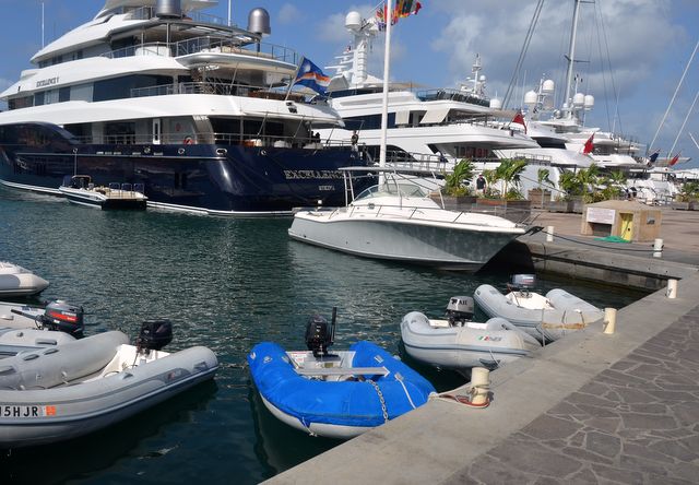
Our new dink (in blue) sharing dock space with other smaller craft
Those formalities out of the way, we did a quick walk through town, checked out the grocery store and were blown away by the chic, expensive shops mainly with high fashion clothes and jewelry. St. Barths is definitely a haven for the rich and famous and way beyond our price range. We rushed back to Pilgrim, anxious about how she was holding in the 3-foot swell and close anchoring quarters. She was fine, but we decided to lift the dinghy onto her davits and stay put until we were sure we were securely anchored.
By dinner time the wind backed from SSE to SE and we were slamming back and forth, side-to-side, in the swell. Jane deferred to Brian to prepare something for dinner and crawled into our bunk right after dinner. It was hard to keep one’s balance and do any work in the galley. We were awakened near midnight with a short rain shower, and again with our anchor alarm sounding several time when the GPS lost accuracy and thought we were adrift. Finally at 5AM the anchor alarm sounded in ernest. We had slipped 40 feet and were getting dangerously close to a 65-foot trimaran. We did not want to attempt to leave the harbour with many anchored and moored boats, many without lights, until first light at 6:15. The trimaran owner was aware of our proximity and put fenders out on his starboard side. Brian plotted a course out of the harbour area without going through most of the boats, and we managed to leave this most uncomfortable anchorage without incident.
The Tri behind us is 65 feet long and ended up very close to us when we dragged the anchor
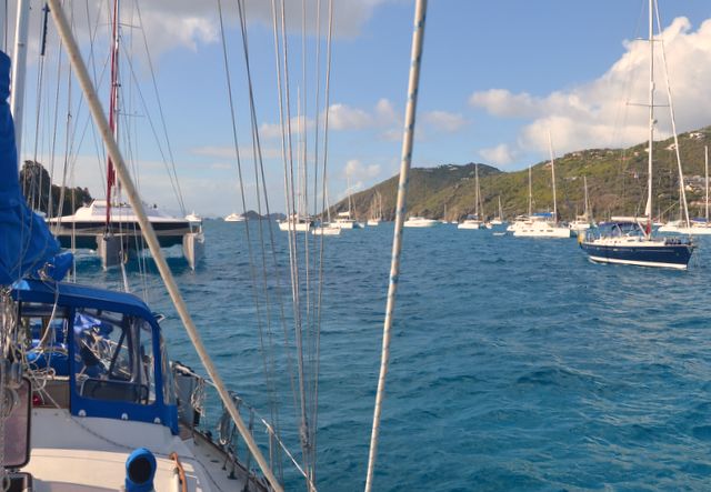
We motored north to Anse de Colombier, a small bay on the NW side of St. Barths and a marine reserve park with moorings. We were able to pick up a mooring and although there was a swell, it was not slamming us like it was in Gustavia harbour. However, the night before we left St. Barths the ocean swell increased to 8 feet from the NNE. If curved around the north end of the island and into the anchorage causing even the mega-yachts to rock and roll. All of them left. Brian had filled one of our pewter wine goblets and set it in a cup holder in the cockpit at dinner time. An especially strong surge filled the harbour, sending the goblet flying into the air and down the aft companionway to the passageway between the main salon and aft cabin. Red wine spilled in the cockpit (cushions, teak and floor) the aft cabin floor, ceiling and counter, and down the passageway. Message to self: no more wine goblets on nights with a surge in the anchorage.
Cruisers give Anse de Colombier high marks. It is a Marine Park in the bay on the NW tip of St. Barths. The bay is deep close into shore and there are about 20 sturdy moorings that have been laid in and maintained by the Marine Park for yachts up to 25 m long or 25 tons to use. We were grateful to be on a mooring here for 6 days during strong trade winds and squalls. Our mooring was in 25 feet of water and the bottom was clearly visible, so we could easily check the mooring. Since the moorings have been installed, turtle grass has become established and there are some green sea turtles living in the bay. However, boats are allowed to anchor outside the moorings. The moorings are on the edges of the bay. Mega-yachts over 100 feet long anchor right in the middle of the bay letting out 200 feet of chain, sometimes with both bow anchors down, and swinging in a huge arc being moved by current, surge and wind that screams down the high hills on the SE side of the bay. Wads of turtle grass are ripped out and seen floating out to sea.


Floating hot tub being assembled by the crew for the owners ashore … anchored mega-yacht tearing up the bottom
It became clear early on in our stay that money talks on St. Barths. The Rockefellers started the trend when they decided they needed another villa in the sun to escape the NE United States weather. Today there are expensive villas on the hillsides and both power and sail mega-yachts in the harbour, glossy guides with ads for high-end clothing and jewelry, and expensive restaurants. One ad for a watch boasted it featured an anemometer, perhaps to measure the speed of hot air coming from other rich and famous people. It was clear that the mega-yachts were exempt from many of the regulations. Beach fires, water skiing, jet skis are not allowed, but are part of the normal toys on the mega-yachts. The inflatable 2-deck high water slide and an inflatable hot tub came out of the “garages” on the mega-yachts along battery-powered surfboards, paddle boards, and an inflatable trampoline. Despite all the toys, we heard cries of boredom from some of the teenagers on the mega-yachts.
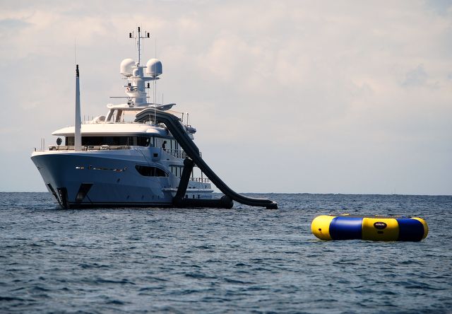
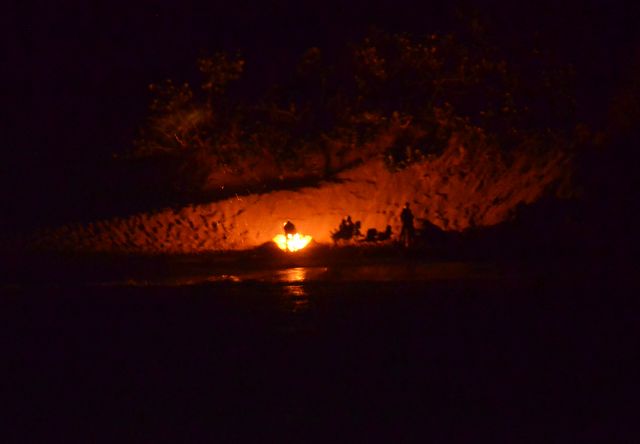
Interestingly only 5 people during the whole day actually used the slide … forbidden fire set on shore courtesy of one of the mega-yachts
There is a coarse sandy beach with many rocks both visible and below water, and a constant surf rolling in making landing a dinghy on the beach tricky. We took a short hike along the trails until we arrived at a locked strong gate leading up to the Rockefeller villa. Because there is no natural source of water on the island and little rainfall, cactus and succulents grow well.
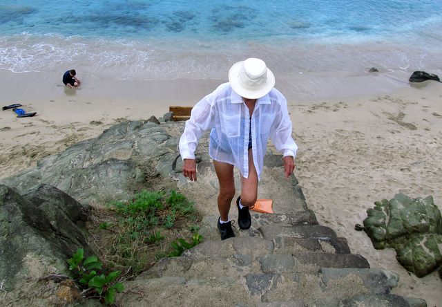
Jane heading up to the walking trail and a view of the anchorage from the top
We encountered large spiders in webs in the cacti, a lizard and a terrapin. Small fish loved the shadow of our boat, the sea turtles were fewer in number than we expected, and the brown boobies were fun to watch diving for fish, much like gannets.
St. Kitts: We waited in St. Barths for weather to sail to St. Kitts. The southeast winds were just not backing to northeast, but when the forecast was for 15 knots from the ESE we decided to move on to St. Kitts. Our plan was to sail down the eastern side of St. Kitts, then through the Narrows between St. Kitts and Nevis and back NE for 5 miles to the capital Basseterre to check in with customs and immigration. The wind was stronger and more southerly than forecast so we changed our route to pass the NW tip of St. Kitts with the volcanic island of Statia on our starboard (right) side. There was so much humidity in the air we could barely see Saba’s 3000-foot volcanic peak, just 20 miles west. The first 30 miles gave us a good reach to the southwest. When we rounded Sandy Point on St. Kitts the wind died, then picked up on the nose as we headed SE down the west coast of St. Kitts. Steep waves slowed us down so much we decided to “motor-tack” down the coast rather than plow into the waves and wind.
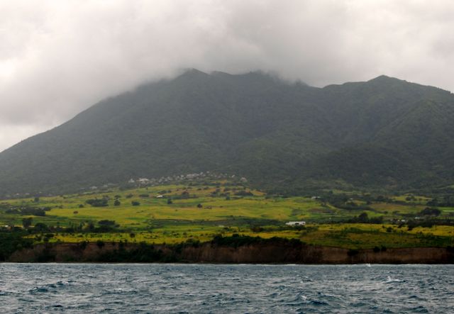
NW tip of St. Kitts
St. Kitts and Nevis is one country, two islands (unlike St. Martin which is one island and two jurisdictions: a country (Sint Maarten) and a French Overseas Collectivity (St. Martin)) Our first order of business was to check in with Customs and Immigration in Basseterre, the capital. There is a marina that has limited space and maneuverability. The marina was not answering VHF radio calls, so we decided to anchor outside the harbour and take the dinghy in to the marina for check in. There was such a huge swell it was difficult to control the dinghy in the water. We decided Brian would go in with our documentation and Jane would stay on Pilgrim to ensure we did not yank out our anchor. The check in process was tedious, requiring Brian to go to 3 separate offices and even to the Casino to get change for a US$20. An hour after Brian left Pilgrim he returned with approval to be in St. Kitts waters. He said getting into the marina with Pilgrim would not work, and that there did not seem to be anyone at the marina to ask about availability of space. We hauled anchor and motored 5 miles SE to Ballast Bay, towing the dinghy. Putting the dinghy back on davits would be been dangerous.
St Kitts cruise ship arrival center one of three stops you need to make to sign in
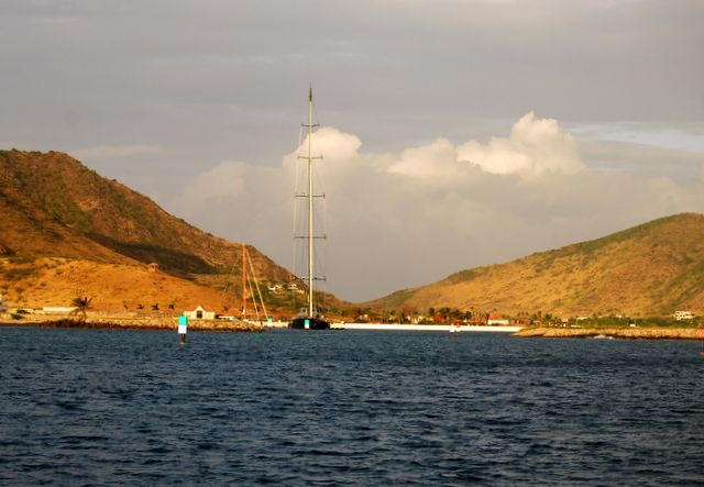
Off Ballast Bay there is a large Salt Pond and a lagoon. A US developer bought most of the southern part of St. Kitts and dredged a channel into the lagoon. A resort with a hotel, condominium apartments and villas, a restaurant and a marina designed only for mega-yachts is well underway. As we rounded the point into the bay we saw a 5-spreader mast with 3 furling headsails. We could not believe the sight. We checked things out with the marina office. The small decrepit marina in Barreterre charges US$.75 / foot for overnight dockage. The mega-yacht marina at Ballast Bay charges US$3.75 / foot (introductory price only!) and does not have any showers / washrooms because people on mega-yachts would never use shore facilities. Ballast Bay was relatively surge-free. We had a reasonably quiet night, more restful that in St. Barths.
A view of the new marina at Ballast Bay … we were welcomed but the facility was for mega-yachts only
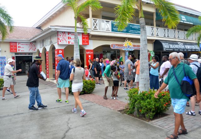
The following day we took our dinghy with its new 9.5 HP outboard back to Basseterre. We clocked our speed at 15 knots, almost 3 times faster than Pilgrim when plowing through seas with headwinds. There were 3 large cruise ships docked at Basseterre’s Port Zante, a development for cruise ships build after Hurricane George demolished the old dock in 1998. It offers duty-free and souvenir shops and bars and restaurants. Some cruise passengers never get beyond Port Zante to see the real capital of St. Kitts because they have fear for their safety. We ventured a bit further into the town, finding 3 Canadian banks with ATMs. St. Kitts was the first country that uses the Eastern Caribbean (EC) dollar as its currency (EC$1. = CN$.56)
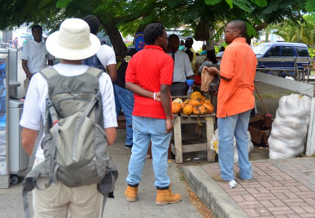
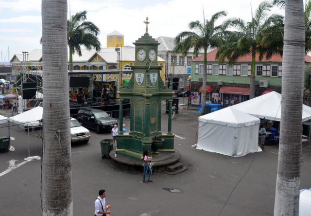
Vegetable and fruit stands are cheek by jowl in the old city … city centre with watering basins and a clock
St. Kitts is still slowly rebuilding after George. The deep gutters on the sides of the streets are an indication of the volume of water streaming down the streets during a tropical storm or hurricane. St. Kitts was a British colony, so driving is on the left. At one busy intersection traffic was gridlocked as a determined egret tried to scrounge every last bit of an abandoned piece of food. The one grocery store we checked out was pretty rudimentary. There were market stands on the street selling local produce. We talked with one stall owner and bought some citrus fruit that was the size of an orange, light green-yellow in colour and warty. The very juicy fruit made a delightful lemonade with sufficient sugar and cool water. We also bought the very tiny bananas with a slightly different taste than the large ones we are more familiar with.
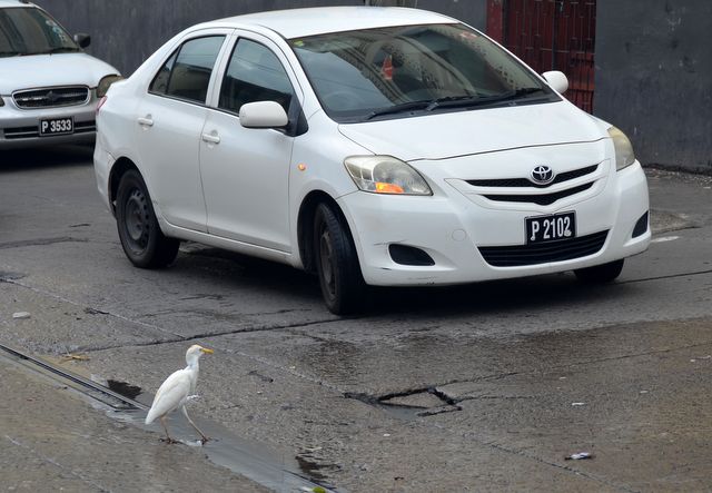
This egret was determined to get food from the water and caused a major gridlock
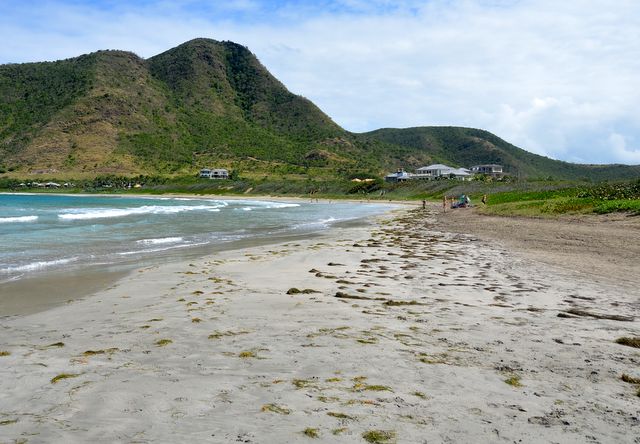
We wanted to to hike on the southern end of St. Kitts past the lagoon and Salt Pond to Sand Banks Beach on the windward side of the island. Now that resort development is going on we were not sure if we could cross the island, so we checked with the marina office and got permission to wander at will. The development is just a few years underway, but already there are a dozen large villas that are occupied, a high-end restaurant, and a planned golf course. At the beach we talked with a young lady from the US doing her veterinary training on St. Kitts with her energetic dog. We saw some of the vervet monkeys that were introduced to the island by plantation owners in the 19th century as pets, but we did not see any mongooses that were also introduced to control the sugarcane-eating rat population. The mongooses preferred chickens and fresh eggs to the rats and are now cursed by the islanders.
This used to be the home site of Gong's Bar before the development started
The anchorages along Nevis’ leeward coast are often rolly with the sea swell, so we decided by bypass Nevis on this trip. We made an overnight passage (80 miles) from St. Kitts to Guadeloupe, leaving a midnight so that we would arrive at the NW anchorage on Guadeloupe midday and also pass Montserrat at dawn. Montserrat has an active volcano that woke up from a long sleep in 1995. In 1997 the capital, Plymouth, had to be evacuated and a marine exclusion zone was established around the south end of the island. In 2012 the volcano was still active. Although we were miles off-shore, photographs of the remains of Plymouth show the powerful destruction of the volcano.
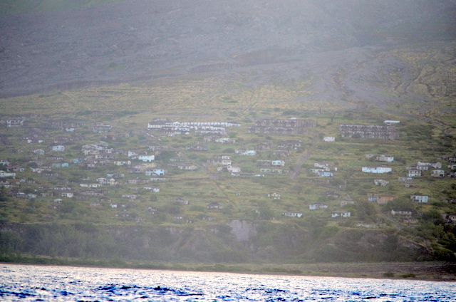
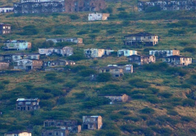
View of Plymouth and a closeup view of the destroyed homes …
One other geologic feature during the trip was passing Redonda, a small island rising almost 1000 feet above the sea, but only 1 mile by 1/2 mile in size. Phosphate was mined on this island in the 19th century and there was even a post office that issued Kingdom of Redonda stamps in 1978. The island is a haven for sea birds, and it is not surprising that we immediately thought of Skellig Michael in Ireland we we saw Redonda in the light of the full moon. Skellig Michael is in the news recently since the last scene of the latest Star Wars movie was shot here. We just heard an interview with a long-time tour guide to Skellig Michael now living in Dingle, Ireland, who claims much damage was done to the nesting sites of the small sea birds that nest on Skellig Michael. Nearby Little Skellig is a nesting site for Gannets and large Sea Gulls, but the smaller Stormy Petrels, puffins, kittiwakes have made Skellig Michael their home. The down draft of the many helicopter flights are reported to have destroyed the perilous nests on the cliffs.