The Carolinas, Georgia and Florida. November, 2013 – January, 2014.
General Observation: Between Bar Harbor, Maine and Marathon, Boot Key, Florida we tied up at 10 marinas. Between Camden in Maine and Marathon in Florida there were no marinas that collected recyclable trash. Many of these marinas claimed to be “green” because they supported pump-outs for cruising boats, but not all of them offered pump-out facilities.
General Question: Is there any correlation between our poor handling of waste and the record-breaking weather we have been experiencing during the winter of 2013/2014? I do not mean to imply that cold fronts arriving every 4-6 days are caused by dumping cans in land fill the previous summer. Recycling has been available for over 2 decades, but has not become a way of life for the boating traveller in the 21st Century in the most powerful country in the world.
Report Card: Could do better. Needs much improvement, but there is not much time left.
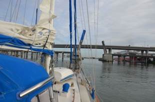
Moorehead City, NC. November 4 – 8. After 48 hours underway from the Chesapeake around Cape Hatteras to Beaufort / Moorhead City, we were not sure if we were going to make it into Moorhead City. To get from Cape Hatteras to Beaufort / Moorhead City you must pass Cape Lookout and its extensive shoal. This shoal adds an extra 20 miles of southerly sailing; once clear of the shoat, there are 35 miles of NE travel into the Beaufort Inlet. When we reached this southerly turning point at 10 PM on Sunday night (just 35 miles to go, out of a total of 290), the wind had veered from north to northeast and it took us another 12 hours to go those last 35 miles.
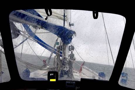
Cold and wet with a motion that simulates a washing machine
Having crossed the Atlantic twice, done extensive sailing in various weather conditions in the Baltic, and having crossed the North Sea, we felt relatively experienced as blue-water sailors. However, being stuck in the northward-traveling Gulf Stream with 20-25 knots of wind from the north (wind against current) caused 10-foot breaking waves on our stern, and led us to say, "we should not have gone around Hatteras." There was virtually no wind on Saturday until 10PM; we motored out the Chesapeake down Virginia Beach and to False Cape. We noticed a grouping of AIS signals from other sailboats, and from several radio communications determined that a group of sailors had left Norfolk on Saturday morning for a trip to the Virgin Islands. They were traveling just south of Cape Hatteras to cross the Gulf Stream. At 10PM the wind quite suddenly built to 15 knots from the west ... perfect conditions for our southeast track to Cape Hatteras. By midnight the wind had veered to north and picked up to 20 knots. We reefed the main and were flying the Genoa on a broad reach. There was a new moon, so little night sky light, but we could feel the huge waves building under us. We were thankful for the darkness; it was enough just to feel the force of the waves traveling under us. We gained an hour (Daylight Savings Fall Back) on Sunday morning, so we have two 3AM log entries. At dawn (around 6AM) we began to see the waves with their white frothy breaking tops, and wished it was still dark. Steering took strength and concentration; thought of food (or food preparation) vanished. We were both concentrated on keeping the boat pointed in the correct direction and keeping the boat from yawing (tipping from side to side under the pressure of waves rushing beneath us). We listened to the chatter of the 20-some boats in the group crossing the Gulf Stream to the Virgin Islands, and were glad we were not attempting that challenge. Just going south on the edge of the stream was enough of a challenge for us. By noon we were past Cape Hatteras, and changed our course westward, to get us out of the Gulf Stream and into waters more protected by the cape. This meant we were on a reach, and running almost broadside to the waves. We were surfing at 10 knots at times, with waves breaking on our topsides and over the cockpit enclosure, another challenge to controlling the boat. Pilgrim took the abuse most admirably, although she did complain by opening up a few new leaks ... Starboard (windward side) chain plates, main cabin hatch, Brian's clothes locker, and Jane's pillow were wet. One of our potted herbs hung in the galley in a self-watering planter fell to the cabin floor, spilling its contents. The fly swatters ended up on the floor. A group of small buckets we keep on the shelf over the hanging locker were spewed all over the floor. Books and pamphlets flew out of the bookcase. Pots and pans in the locker and food containers in the fridge were a jumble. Monday morning, after we "turned to corner" and headed NE, the wind built to 25-30 knots and the waves were pounding our bow, sending spray over the cockpit. Although we were not using the motor on Sunday on Monday it died on us twice due to problems with the fuel delivery system. It was a relief to tie the dock lines and inspect the damage in Moorhead City ... lots of salt everywhere, a chafed-through line securing the dinghy on davits, an almost-lost spinnaker halyard. Did I mention salt... the zippers on the enclosure were almost impossible to open and close.
Would we do it again? No. Talking with those who have made this trip before led us to believe that if we kept close to shore we would not encounter the effects of the Gulf Stream. These folks obviously had not made the passage with 20-25 knot northerly winds. We've got the T-shirt. No more Hatteras for us.
We spent time with Brian Roberts and his partner, Luzia. They crossed the Atlantic with us in 2007, sold their boat a couple of years ago but have recently purchased an old Westerly sailboat that needs much loving care. It is on land in Moorhead City and they are living on board while working on the boat.
Brian and Luzia’s new treasure
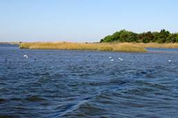
Winyah Bay, SC. November 9 - 11. We anchored in Winyah Bay, SC, in the same location we anchored in 2006. This is evidently the North American landing spot of the Witherspoons who left Scotland for Ireland, then took passage from Ireland to America. It is definitely "low country." The shoreline is swampy reed beds. It is difficult to determine there is land until you are just 5 miles offshore.
Fast currents and shallows right off the channel make for interesting anchoring challenges
The passage from Beaufort / Moorehead City was benign compared with the Hatteras passage. Wind speed never topped 23 and was mainly from the north to northeast, so if anything too much of a run with the 4-foot waves. Brian had a line out for a short time until the dolphins came to swim with us. Nothing caught. The passage was just what both of us needed to rebuild our confidence after the Hatteras passage.
The major excitement on the passage was being in the middle of US Navy manoeuvres with a helicopter/ STOL carrier, then a destroyer, and then another aircraft carrier with an escort. The escort carried an AIS signal and displayed the name, "X Albarack 8 X." We were asked to alter course twice. The second time the radio operator insisted he was on our port bow, but he was on our starboard bow. Finally he corrected himself.
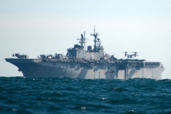
A Vertical Takeoff and Landing aircraft carrier
While swapping stories with Don on the 60-foot catamaran, Cat's Meow, in Sarah Creek, he mentioned a long motoring slug against the current several years ago going up Winyah Bay with vicious flies biting him and his two cats. One of the cats couldn't stand the flies and ran to the bow of the boat. That is where he lost track of the cat, but at the same instance, Don says he saw an alligator swimming alongside of the boat. Don hoped the cat (whom he assumed had jumped overboard to avoid the flies) was killed by his propeller rather than succumbed to the alligator. The story has a happy ending: the cat was hiding under a cushion and was discovered after they docked in Georgetown. With this story in mind, we watched the banks and waters for alligators, but did not see any and cannot imagine how one would get on the reedy bank to sun.
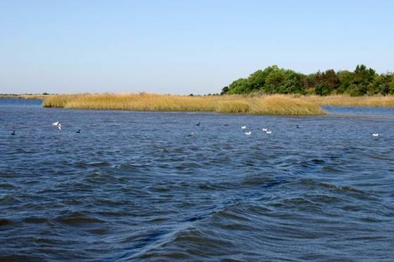
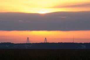
Charleston, SC. November 12 – 21. We spent 2 days "in the ditch," the ICW. This is the 50-mile run that makes sense since going outside would require entering Charleston Harbor and unless you time your entry with a flood current the trip to a marina or anchorage could take a LONG time. Entering Charleston from the ICW avoids a very long approach to the harbour. However, the ICW did have its challenges ... and its beauties. On the beautiful side, just as we entered the waterway from the Winyah Bay anchorage, an eagle swooped down right in front of our boat and caught a fish. The lovely white egrets and herons lined the reed-choked shoreline. The biggest surprise was a couple of pods of dolphins swimming in the ditch in 15-feet of water. Perhaps they somehow got caught in the waterway and cannot figure out how to get out.
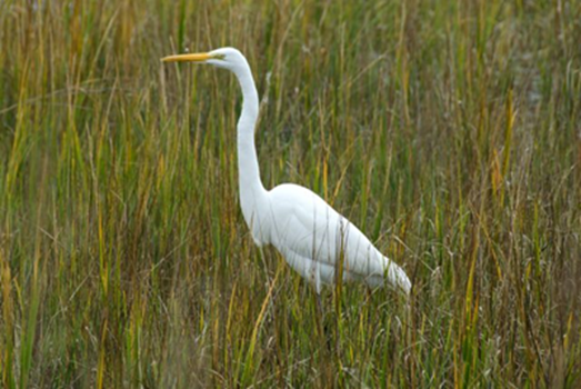
Great Egret looking for a snack
This 50-mile stretch of the waterway is relatively easy. There is only one opening bridge (on demand between 9AM and 4PM) one 65-foot high fixed bridge (Pilgrim requires 63-feet clearance), and one cable ferry that had no traffic when we passed. There were only 7 power boats that passed us, and they were all very well behaved. One sailboat also passed us. However, the shoaling in the waterway, especially where creeks and rivers cross each other is tricky. It was a boon having the chart plotter with its "magenta line" showing the middle of the waterway. We steered for navigation aids rather than stick rigidly to the magenta line a couple of times, and found ourselves in thin water. In the afternoon, with the sun shining in our eyes, moving focus from the chart plotter to the waterway and navigation aids was blinding. We were keen to drop the hook at 2:30 in Whiteside Creek, where we also anchored in 2006. We were the only cruiser anchored this year.
Great anchorage but it can become very shallow requiring you to pole your way along
We timed our departure from the anchorage to arrive in Charleston Harbor with slack water to make getting up the Cooper River and docking as easy as possible. The sailboat that passed us on Monday was sitting in the middle of the waterway when we got to the Isle of Palms. Yes, they ran aground right on the magenta line. However, they draw 6'2" (we draw 5'5") and it was low tide (tidal range is 5 feet). As we approached we spoke on the radio. They could not advise us which side of them had more water; we took their port side, and started to slow down due to bottom interference. We raised the engine RPM and slowly wiggled off the bottom. However, 4 more times we slowed down, and once we even had a major BUMP ... but we never stopped dead in the water. Later we noticed that the stuck sailboat's AIS signal was moving again.
A
very narrow band of land seperates two channels
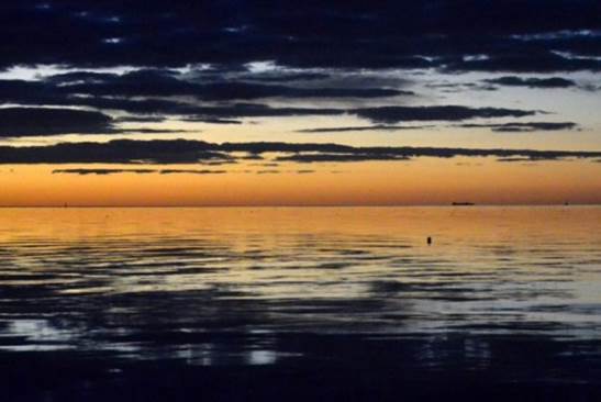
A sunset over Charleston
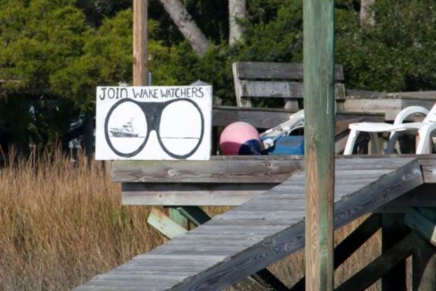
The ICW dwellers are very concerned about shore erosion due to boaters and their boat wakes
The weather was benign with a 10 knot wind from the west, but gale warnings were forecast for the evening along with frost warnings. The offshore forecast predicted 13 - 17 foot waves. We stayed 2 nights at the Cooper River Marina to wait out the gale. Then we went to the Ashly River anchorage for 4 days which is closer to downtown and the marina with a megadock that had our mail.
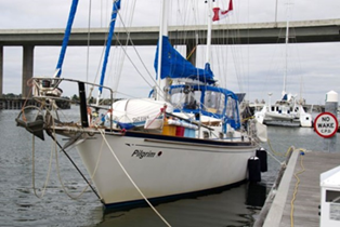
Pilgrim tied up at the mini-mega-dock Loading up on the necessities of life
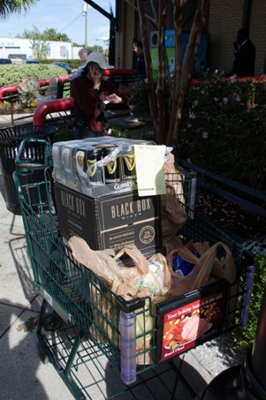
We spent our last two days at the Charleston City Marina because a cold front with strong northerlies came through the area. We did a major re-provisioning and continued to work on basic maintenance, especially fixing leaks due to the boat flexing during our Hatteras rounding. Our last day in Charleston we did some walking-sight-seeing. The very limited historic downtown area is charming, with many of the old homes with 2 and 3 story verandas being restored as single-family homes. When a local resident thought we were venturing outside the tourist area, he quickly suggested "don't even cross the street here" to keep us on the safe side of the tracks. During our walk we met a delightful couple and their two young sons who are on a 48-foot catamaran, home-schooling the children and living full-time on the boat. They come from Chicago and have been on the boat for a year. The kids have learned to be as at home with adults as kids their own age.
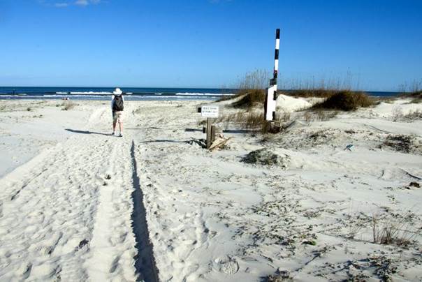
Cumberland Island, GA. Nov 22 -25, December 1. Thursday and Friday morning we sailed the 170 nm from Charleston to Cumberland Inlet. The wind started out 15 - 23 knots from the NE. We sailed with just the Genoa poled out and were able to keep our speed up around 6.5 - 7 knots, but the seas were high and breaking. At 8PM (about 1/3 of the way down the coast) the wind dropped to 12 knots, but the seas remained high enough to slam the wind out of the sails, so we motor-sailed the remaining 2/3. The waves consisted of swells from the east with wind waves from the north, which gave the ocean a "washing machine" effect... uncomfortable, tossing us from sleeping positions when we were off watch. We anchored mid-afternoon west of the south end of Cumberland Island, just off Greyfield's Inn. We set two anchors, Bahamian-style, one for the flood current and the other for the ebb current. However, the wind has been strong from the north and northeast, and the flood current anchor did not seen any action... the wind won over the current.
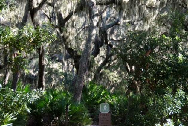
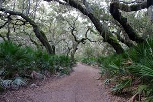
Saturday and Monday we went ashore. Cumberland Island is a National Park Service park and an enchanting place to explore. Much is the same as when we were here in 2006 (see our website for description and photos). However, sadly there are few armadillos left (no one seems to know why). The armadillos arrived on the island in 1974, supposedly swimming from their native habitat on the mainland to the island. While the armadillos have decreased in number, the wild horses have multiplied. We also saw a white-tailed deer, but have not seen the wild bores this year. With the strong NE wind, the surf on the ocean beach was spectacular and almost too painful to walk on with the blowing fine sand. The maritime forest with its canopy of live oaks draped in Spanish moss is so soothing. Even the strong wind could not penetrate the calm of the forest.
Fine white sand and strong winds are painful to contact lens wearers
Spanish moss hanging from the live oak trees

A forest out of middle earth The wild horses exist in spite of the park rangers
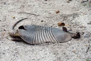
Unfortunately the few armadillos and snakes aren’t so lucky
We returned to Cumberland Island for another day after Thanksgiving in St. Mary’s and took a park tour via van to the north end of the island with stops. Our tour guide was very opinionated, but also well informed and researched in issues that are part of Cumberland Island's past. It was a worthwhile tour; the day was blustery and threatened rain, but remained dry for us. The focus of the tour was on the Thomas Carnegie family history on the island, a tour of Plum Orchard, the house Lucy Carnegie had built for her oldest son when he married and the natural history of the island.
The
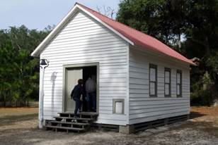
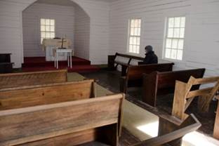
Settlements 1 st A. B. Church founded in
1893 ... site of John John Kennedy's wedding
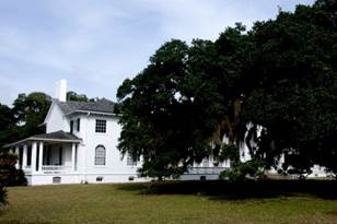

Plum Orchard
Plum Orchard
St. Mary’s GA. Nov 26 - 30. The weather in southern Georgia was almost as bad as just about everywhere in North America over the Thanksgiving weekend. Buckets of rain fell on Tuesday followed by tornado watch (did not materialize), then gale-force SW à W winds (we had two anchors out, only one boat of the 25 anchored for the festivities dragged), and an overnight freeze advisory. It was sunny (Praise the Lord … the enclosed cockpit was toasty) but the temperature was 44 degrees F in the cabin.
Cape Canaveral, FL. December 2 – 20.
The wind was very light, but from the NE, which kept an uncomfortable swell through most of the 28 hour trip from St. Mary’s Inlet to Cape Canaveral Inlet. The head sails gave us a little boost in speed early on Monday.
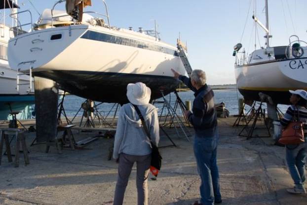
As we approached Cape Canaveral we heard a Coast Guard broadcast about restrictions around Cape Canaveral. We discovered there was a launch planned of a communications satellite, but that the restrictions did not come into play until 3PM, by which time we had cleared the area. When we arrived at the marina, we learned that they wanted to haul us out on Tuesday, rather than Wednesday. We said OK... not realizing how tired we were from the overnight passage, and that we were famished. We had planned to have a substantial brunch when we docked, but were diverted from that to get the boat ready for haul out (Head sails off, SSB antenna off, 4x4 standoffs in place to keep the rubrail from being crushed when the Travelift lifted us out of the water etc. etc.) By the time we were taken to the "bath" area for a power wash to the hull, we were both exhausted. The power wash took longer than anticipated; we had much green growth on the hull this year. Finally at 5PM Pilgrim was settled in her dry home on stands. As Brian worked on the oil change and Jane opened ports (it was finally warm!) a loud rumbling and banging interrupted our work. The communications satellite was launched, and we saw it... truly awesome. Unfortunately no photos; we were too tired and unprepared.
During the 2 weeks out of the water we bought a new prop shaft and stuffing box, new coupler, and a cutter (to help insure we do not pick up any floating lines around our prop shaft in the future). We cleaned and waxed topsides and applied a fresh coat of sloughing paint on the bottom. We also hope that we plugged some leaks we have encountered in the past month.
After launching, we bent on the two head sails, secured the dinghy to the foredeck, and methodically hosed off the grime accumulated in the yard.
Palm Beach / Lake Worth, FL. December 21 – January 5. It was a relief to get Pilgrim back in the water. After topping up our fuel and water, we left Cape Canaveral at 8:30 on Thursday morning for the 100 nm trip to Lake Worth Inlet. The new stuffing box, prop shaft and coupler behaved well on the trip to Lake Worth, mainly under engine power. The Eastern seaboard with its barrier islands / Intra Coastal waterway has a number of inlets, but few of them are Classified as "A" Inlets (used by cruise and cargo ships). There is only one inlet between Cape Canaveral and Palm Beach that is Class A (Fort Pearce), and we could not get to it before sunset on Thursday, so the Lake Worth Inlet was our only choice. During our 18-hour trip there were two major incidents: a research vessel tried to get into St. Lucie Inlet and grounded. We could see its AIS signal, and also the signals for two tugs that were attempting to rescue / salvage the boat. The other incident involved a 24-foot sailboat that had gone aground in Jupiter Inlet or hear Juno Beach and lost a person overboard. There were numerous coast guard transmissions for help finding the missing person. We also saw a rescue helicopter with a searchlight crisscrossing the area, a rescue boat, and emergency vehicles on a pier when we passed.
We had northerly winds for 4 days while we were in the yard, which brought cool weather (good for working). On Thursday the wind backed to east bringing warmer weather. However, now we are far enough south to be in the tropics and not feel the effects of northerly fronts. The water turned tropical turquoise during our passage and the water temperature rose to 73 degrees F. We also "caught" 3 flying fish during our passage. It is also quite warm... low 80's F. Conventional fishing yielded nothing.
We arrived at Lake Worth Inlet at 3:30 AM Friday morning, with a 3.5 knot ebb current flowing against our passage from the ocean into the waterway. We had been experiencing up to 2 knots of adverse current much of the trip. The Gulf Stream is only 3 miles east of the inlet, so we were probably experiencing Gulf Stream effects. Thanks to a nearly full moon, we managed to get into the inlet, find the critical navigation aids and got to the anchorage we were in in 2007. Entering an anchorage after sunset is something we try to avoid, but the combination of chart plotter, radar and Brian's excellent eyesight and gut feel kept us on course.
Lake Worth anchorage. There are shrink wrapped yachts in the background
After 2 weeks of intensive boat work at Cape Canaveral, it was great to have a down day today, waking up at 11, having breakfast, rinsing the salt residue off the boat, reading and needle-crafting. The only problem with anchorage south of the inlet is the lack of any unsecured internet access and shore access.
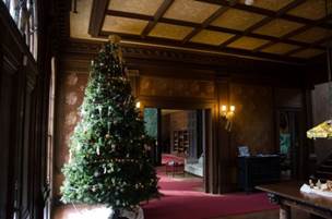
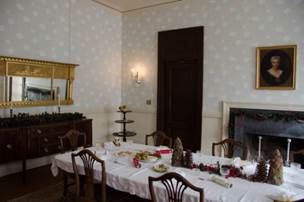
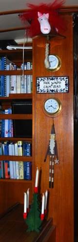
During our week in the anchorage, we celebrated a very green Christmas. We had our tiny Christmas tree besides our Saint Nicholas (patron saint of sailors) which resides on the mast casement near our cabin table. We had one gift to open from our grandson (very tasteful plates with sea-theme images ... crab, whale, sea horse, and octopus). We listened to NPR /APM Christmas music with lots of references to snow and the bleak mid-winter. Our first Christmas on the boat was pleasant and memorable. We wore shorts, T-shirts and sandals, with plenty of sunscreen and bug spray.
Our Christmas tree, St. Nick and Olivia the guardian angel … having breakfast on Gavin’s gift
After a week in the anchorage, we moved to a dock at the Sailfish Marina and Resort. The tidal currents at the marina, very near the Lake Worth Inlet, were very strong (2+ knots), so we timed our arrival for 7AM close to slack with high water, since the depths were also a concern. We landed with help from the marina staff after our first attempt at landing without help failed. Our daughter, son-in-law and grandson arrived from Washington DC Saturday evening and stayed in the resort section of the marina. The on-site restaurant had reasonable quality and price. We used our shore time to do laundry, grocery shopping, computer repair (Jane's system was badly attacked and required much remedial repair), and recharging of all our electrical / electronic devices. We also had time to go to several nearby parks.
The Sailfish Marina and Resort small dock Public beach on the Atlantic side
The first park we visited was Blowing Rocks Nature Conservancy on Jupiter Island, the barrier island just north of Singer Island where the marina is located. The park had a boardwalk over the western side of the island (the lagoon) bordering on the Intracoastal Waterway (ICW). It also had a spectacular Atlantic beach studded with limestone rocks that caused the breakers the shoot into the air at high tide when the surf was high. There was also a lovely walk in the maritime hammock (forest, mainly of palms and subtropical trees) just west of the dunes and the Atlantic beach. It was fascinating for us to compare Jupiter Island in tropical Florida with Cumberland Island on the Florida/Georgia border. Both barrier islands have similar ocean-side beaches on the east side of the island, dunes, woodland areas, and then bogs or swamp on the ICW / west side of the island. The plant and animal life is dramatically different.
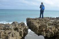
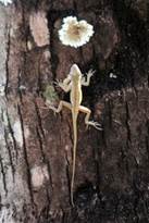
Surf fishing Blowing Rocks formations lizard up a tree
Tuesday we took the water taxi to Peanut Island just 300 yards west of the marina. It is a manmade island, mainly built up from the dredged material of the ICW and the Lake Worth Inlet, which was built in the 1930's. Before the inlet was dug, Lake Worth was a shallow freshwater lake without direct to the ocean. This state park has an decommissioned coast guard station and a bunker built for John F. Kennedy when he was president in case of a nuclear attack when he was vacationing in Palm Beach. It also has a manmade reef for snorkelling and a great walkway through mangrove areas.
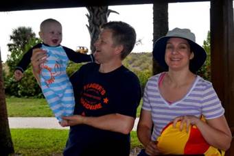
Everyone enjoying a day at the beach and on the boat
Wednesday we went to the John D. MacArthur Beach State Park at the north end of Singer Island (barrier island at the north end of the Lake Worth), with another good Atlantic beach, nature trails and an education centre. Thursday we were on the beach just several blocks from the marina after swimming in the marina pool.
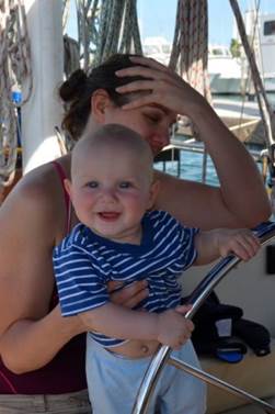
Our grandson had a great time on Pilgrim, taking a real shine to the wheel. We were not sure if he wanted to become the captain, or if it was a big teething ring.
Miami Beach, FL. January 6 - 11
We left the Lake Worth anchorage at 7PM, picked out way out the channel and inlet, and headed due south for 66 miles. The forecast was for S to SW winds up to 15 knots, but the maximum we saw was 10 knots, and the wind had little impact on our progress. It was all motor-power, however. The waves were forecast to be 4-6 feet with occasional 8 foot waves. Although the ride was far from smooth, we did not experience any breaking waves, and nothing more than 3 feet. We think we were just plain lucky. We arrived at Miami's Government Cut channel at 7AM, just as the tide began to rise. One patch of water to the anchorage was a bit thin for us … 5 feet, and we wanted to be well into a rising tide before entering the anchorage. Other than being re-directed out of the main channel to the fisherman's channel (too many cruise ships docked in the main channel and we posed a security threat) the trip was easy and uneventful.
The anchorage at Miami Beach was an eye-opener. The large lagoon inside the barrier islands has been over-developed with many manmade islands and mini-lagoon channels. Some of the channels that pass the manmade islands are deep enough for pleasure boats, like us, and there are places that boats anchor. Some of us anchor for a few days or even a week. Some of the boats anchor out for the rest of their lives. Many are missing masts, have very scummy waterlines and makeshift tarpaulins as dodgers/biminis. There are tall apartment buildings on the barrier islands, and luxurious homes on the manmade islands.
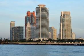
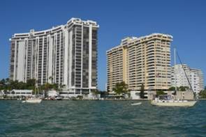
Condos everywhere and with no regard to water levels
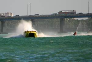
Causeways join the manmade islands, and occasionally there is a bascule bridge that opens on a schedule or on demand. Throughout this rather unnatural waterway, there is a 35 MPH speed limit, which is high for most boats. WOW....watch out poor manatees. The personal watercraft, cigarette boats, tour boats and amphibious tour buses kick up quite the wake and make a racket of noise.
Fortunately for us, two of the days we were anchored there was high wind and rain which dampened the traffic.
The bridge is normally open due to the amount of boat traffic … trill seekers big and small
Miami Beach is basically a grown up playground. There were always a dozen huge cruise liners taking on and letting off passengers, with 24 hour turnaround for the next batch of cruisers. Paddle boards, kayaks, runabouts, and personal watercraft were available for rent. The pools at the foot of the high rise apartments were crowded with people soaking up the sun on the days we had sun.
Cat playing with the boats at anchor Water walker or attention seeker
Cruise boats and their security needs close the government cut to all other boaters
We rowed the dinghy ashore twice to get groceries and hardware. There was a basic supermarket (Publix) close by to the dinghy tie up location, but there were also two very high end (expensive) stores offering all kinds of exotic foods. One new food for us is Meyers Lemons. We have only found them in Florida. They are small, and as they ripen they turn orange. They have a distinctive somewhat sweet flavour. We bought a bag at one of the high end shops. When we got home we noticed the label on the bag read "Product of Canada." Very Exotic!
We met an eccentric lady in the other high end grocery store, who was wearing Canadian flag label pins and claimed to be a professor of extra-terrestrial science, teaching in Montreal, California and Florida. Brian's few probing questions proved her a likable fake. The Ace Hardware store was about the most useless hardware store we have ever seen. There were lots of house wares and cleaning supplies, but few tools and no marine supplies. In fact, there are no chandleries in Miami Beach. We actually passed the hardware store twice before noticing where the entrance was.
The buildings in downtown Miami were lit up at night with videos of dancing girls, and coloured lights. At 10:40 Saturday night there was a coordinated show of fireworks ... this well after we had turned in for the night, but which was an excellent alarm clock. All in all, we found the area somewhat unsettling, were happy to move on.
One building displays an animated pole dancer while another changes colour to some unheard music
With the promise of west to northwest to north winds less than 20 knots, we left Miami Beach for our first anchorage in the Florida Keys. As we were motoring out of the anchorage at Miami Beach we were joined by a catamaran. They hailed us on the radio and asked, "Are you the Pilgrim we saw in Pryner's Cove?" We replied, "You mean Pryner's Cove in Lake Ontario?" "Yes," they responded. "We were there in May 2006 as we were leaving the Great Lakes," we replied. It turns out they were in the same anchorage with us just outside Picton on our way to Kingston back in 2006. They told us that I (Jane) had kayaked over to their boat and gave them our boat card. They followed us ever since on our website. It is amazing how small the cruising world can be.
The ICW continues south of Miami through Biscayne Bay and a buoyed channel with depths as low as 4.5 feet. That is not the route we took. The Hawke Channel is the "outside ICW." It is on the eastern / southern side of the keys, but is also sheltered by a submerged reef that runs parallel to the keys. There are navigation aids to keep you off the shallowest reefs, and the depths are generally over 10 feet. The unfortunate feature of the Hawke Channel is the lack of good anchorages. We travelled over 20 miles to the first anchorage which is in between the fairly large Largo Key on the west and Rodriguez Key on the east. The anchorage is totally unprotected on the north, which was the wind direction when we arrived.
Rodriguez Key … Wonderful anchorage
There was some bounce, but nothing uncomfortable and no ocean swell. The reef between the Atlantic and the Hawke Channel dampened the waves nicely during our passage.
The following day we SAILED without the engine on for the first time since we made the trip from Charleston to St. Mary's (that was before US Thanksgiving!) Our course was mainly SW to WSW and the wind was 15-18 knots from the East. It was hazy and warm, so the wind felt refreshingly cool. The Long Key Bight anchorage was 26 miles from the Rodriguez Key anchorage. It was a perfect place to wait out a cold front, which brought only 25 knot winds from the northwest and choppy seas, but delightfully cool weather (50 degrees F at night and up to the low to mid 60's during the day.)
The Long Key Bight … A safe anchorage while we waited out yet another cold front
Our cruising guides warned us that the Hawke Channel is riddled with crab and lobster floats, but during our first 20 miles we saw only a few. During the next 50 miles the number of floats increased exponentially. Most of the floats are spherical with a stick-like handle protruding from the top, making them look like comic book bombs. Sometimes two floats were together, making them a "cluster bomb." Before the cold front came through the fish harvesters were out tending their traps before the strong winds hit. Despite the number of floats, lobster is dear, costing $13/ pound and fresh crab are nowhere in the market. Dawn on our last morning at Long Key was spectacular. There was no wind, not even a ripple on the mighty ocean as the sun greeted us.
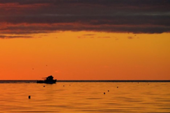
Fishing boat headed out of The Long Key Bight
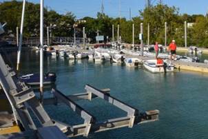
Our last port in the Keys was Marathon or Boot Key Harbor, a very well-protected harbour at the elbow where the keys bend to the west to Key West. The city manages a field of 226 moorings, in addition to half a dozen marinas with fixed docks. In short, this place is loaded with boats. At sunset we were amazed at the number of anchor lights on anchored and moored boats. A virtual city of lights. We anchored east of the huge mooring field our first night, and then were assigned a mooring
A mooring in Boot Key Harbor costs $22 / day, which gives you the right to land a dingy, showers, laundry facilities, and dockside or boat-side pump out.

Fine
white sand and clay hold very well in the tightly packed Marathon anchorage
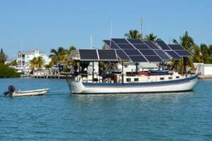
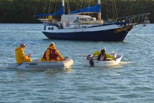
A
solar powered boat
getting a dinghy tow
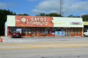
Fish
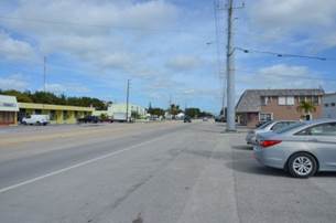
market only a half mile from the marina US #1 has crosswalks and lights about every half
mile
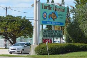
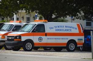
The
Turtle Hospial and Ambulance … they have an adoption program as well … are
people as well cared for?
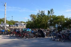
Bike
storage and dinghy docks are all part of the Marathon Public Marina package to
maintain law and order amoug the 200 plus boats that are moored and anchored.
The City of Marathon has marine supplies and services, a large grocery store and drug store. Unfortunately for the cruiser without bicycles, the city is strung along a highway and designed for people with cars. Fortunately, this design gives a couple of aging cruisers a good workout walk to get supplies. Marathon is also a good, secure place to wait for a weather window to cross the Gulf Stream and go south.