Newfoundland: Notre Dame Bay to Cape Race, June & July
2012
Lewisporte: The day we launched Pilgrim was the first day of rain that lasted for two weeks. The rain was accompanied by high north winds and cold temperatures.
The weather put quite a damper on completing commissioning. 3 weeks after launch, we finally pushed off the dock, and had a gentle sail to our first anchorage. As we motored out of the bay on which Lewisporte is situated, we noticed two rusting scuttled whaling or fishing boats in Jobs Cove which we had not seen last August when we were being towed to Lewisporte with a disabled engine and a 20 knot SW head wind. Our exit was much less stressful that our entrance last August without an engine. Once out in Indian Arm we were able to hoist the main and sail up the shipping channel along with a departing cargo ship riding high out of the water. The cargo ship, the pilot boat and Pilgrim were the only boats on the water. Summer had not begun yet for most Newfoundland sailors.
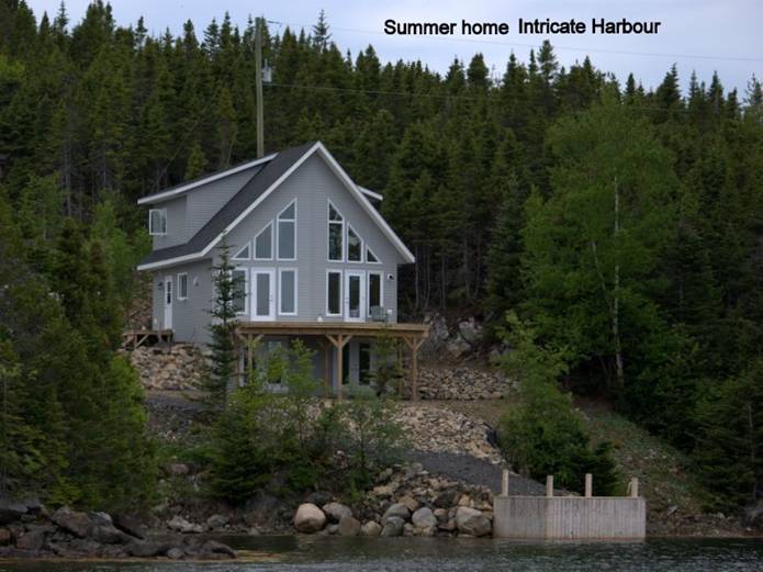
Intricate Harbour, New World Island: This cove has islets at its mouth requiring caution, but the electronic charts were good and Brian keeping watch on the bow kept us safe. Inside the cove, we seemed to be land-locked. There were two large cottages under construction and a sea kayaking centre that did not appear to be in operation yet. It was great to be swinging on the hook in a quiet harbour.
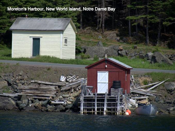
Moreton’s Harbour, New World Island. NE winds gave us our second passage testing on tacking skills. A coast guard cutter was the only other boat we saw as we tacked out the shipping channel and around Western Head. We could see a grounded ice berg in the distance in the west, perhaps on Long Island. There is a government wharf in good condition in Cross Cove with several fishing boats tied up to it. We decided to anchor opposite Cross Cove, avoiding several floats marking local fish nets. There was some car traffic on the road that circled the cove, but little evidence of people living in the houses. Most of the wharves were in poor condition. Moreton’s Harbour, along with Fogo and Twillingate, is one of the three harbours “all around the circle” immortalized in the song “I’se the Bye” describing a former time of prosperity from the cod fishery.
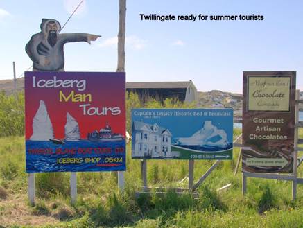
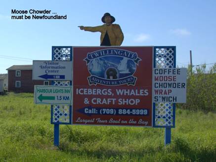
Twillingate, South Twillingate Island: It was a short motor trip against the wind to get to this tourist destination, but once again we discovered that Twillingate was not ready for visiting boaters. The description in our two cruising guides talk about floating docks and a small marina, but all we could find were 4 fishing wharfs with quite a few fishing boats tied up.
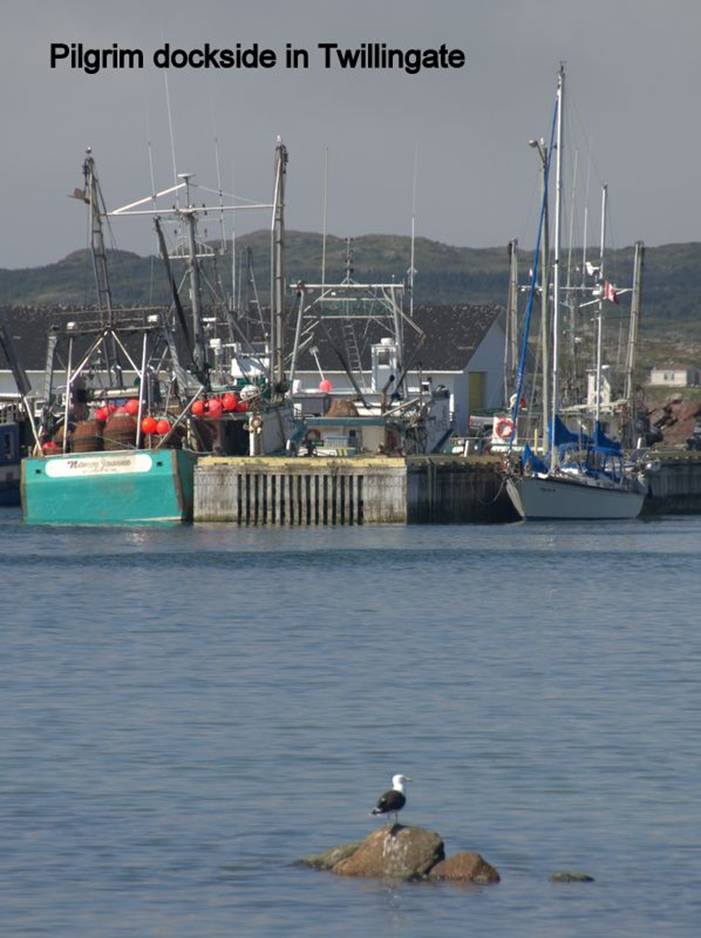
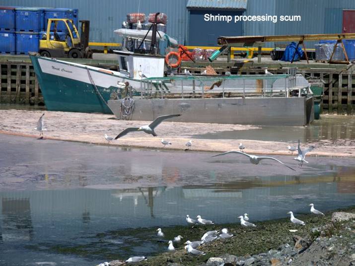
The shrimp processing plant was spewing forth its pink scum, and a boom attempted to contain the mess that attracted many gulls. We landed at the wharf closest to the shrimp plant and inquired from some of the workers where we should tie up. No one knew. We called the one telephone number we had … a tourist office, and got the phone number for the mayor of Twillingate. He also happened to be the harbour master, we learned later. We were directed to one of the other wharves, and managed to tie up and find an electrical hook up and a WIFI service. Later, when the harbour master arrived, we learned that the docking fee would be $9.50 per night $2.50 for the electrical hook up … so we said we would stay 2 nights. As a tourist destination, we were surprised that there was no map of the town showing the tourist sites and very little signage to help us get around. The Twillingate Museum, the tourist information office, the grocery store, Liquor Express and several restaurants are on the North Twillingate Island. The Durrell Museum and Auk Island Winery (berry wines) are in the opposite direction from the fishing wharfs and about the same distance. Thus, if you arrive in Twillingate without a motor vehicle, there is much walking to get around. We opted for North Twillingate and went to the Twillingate Museum, grocery & liquor stores. Sunday we attended the service at the Central United Church, a 1986 amalgamation of several smaller congregations in a new and attractive building close to the fishing wharf. We were warmly received by the congregation. We rounded out our Sunday by taking advantage of the showers, the washer and dryer in the harbour office.
Twillingate advertises itself to be the Ice berg capital of the world! We did not see any evidence of ice bergs, although we understand there was a small one grounded near Durrell. St. Anthony still tops our list for ice bergs.
We heard on the VHF radio (Notice to Fishers) that the snow crab season had been extended. Since we were tied to the fishing wharf and there were boats unloading (shrimp for processing in Twillingate and crab for immediate transportation to a crab processing plant) we fell into conversations with a fishery officer and also a commercial fisherman. We said we supposed the snow crab season had been extended because of a bountiful season. We learned just the opposite was true. The season in the Twillingate / Fogo Island area had been poor and was extended to enable the commercial fishermen to fill their quotas. However, the catches during the extension were hardly enough to pay expenses. This is how our government ensures the fish stocks remain sustainable!
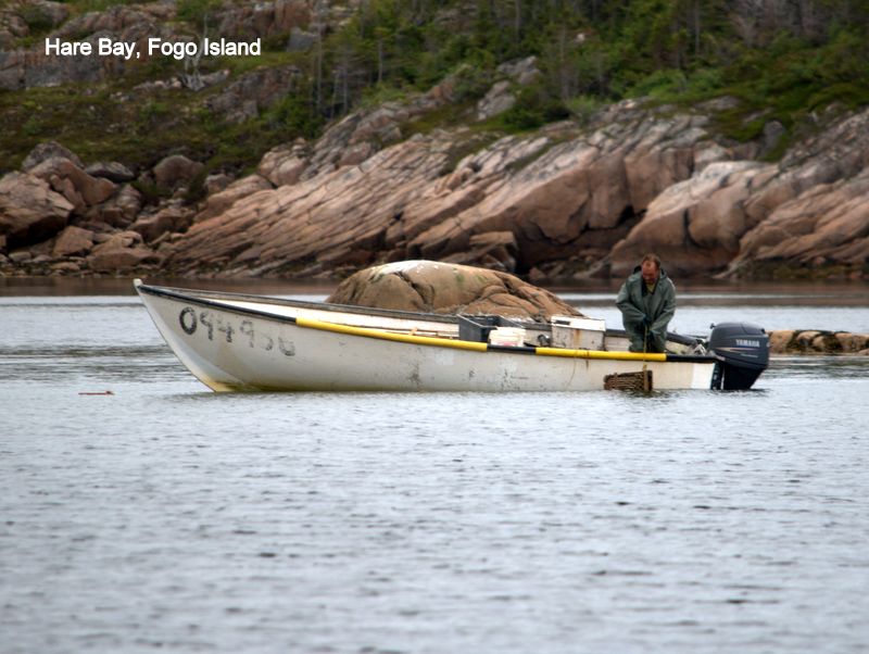
Hare Bay, Fogo Island. We had a lazy broad reach sail in a gentle SW breeze to Fogo Island. Our two cruising guides described an anchorage just beside the village of Deep Cove, but we decided to go further into Hare Bay to find a secluded anchorage farther away from the village. The broad 19-foot shelf shown on our electronic chart did not materialize. We found a patch of 24-foot water, but as we went toward shore the depths just kept getting deeper and deeper. Another cove provided a narrow shelf for the anchor, and by the time we had played out 100 feet of chain, we were in 45 foot depths. Fortunately there was little wind; we think we were anchored on rocks. A lone loon serenaded us with its plaintive song. Wooden lobster traps on the shoreline and an open boat checking traps in the water made us hopeful there were fish in Hare Bay.
Fogo Island has been declared one of the 4 corners of the world by the Flat Earth Society.
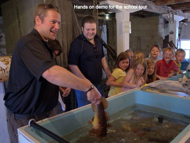
Seldom Come By, Fogo Island. The name of this little village on the south coast of Fogo Island comes from a time in the 19th century when schooner captains sailing from Newfoundland to southern Labrador in the spring, or sailing from Labrador home in the fall, seldom passed by this sheltered deep water harbour. We tied up at the Marine Information Centre wharf, the site of the Fishermen’s Union Trading Company and Cod Liver Oil Factory, both now museums. The tourist / boating season had not begun yet, so the showers were not available and the museum was not open. We were welcome to tie up and use the electrical hookup. Staff preparing the site for the summer invited us to tour the museum and join a Grade 2 field trip.
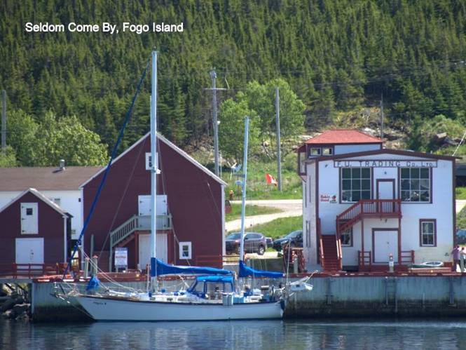
The history of the cooperative goes back to the early 1960’s when Joey Smallwood, the first premier of Newfoundland and Labrador, wanted to modernize and consolidate rural outports into larger processing sites. Whole communities were resettled from outports accessible only by boat, to these centralized sites. The Newfoundland Labrador Export Company, the island’s main fish buyer, decided to close down operations on Fogo. The people on Fogo refused resettlement and formed the Fogo Island Shipbuilding and Producers Co-operative Society, with a co-op store in Seldom. This gave the residents of Fogo Island employment and an organization to buy fish products, and allowed them to stay on their island. The shipbuilding industry is no longer in operation, and with the cod fishery closed, livelihood continues to challenge the residents; the focus on tourism has helped meet that challenge.
There are 3 buildings in the museum: the store and office has been restored with artifacts from the 20th century. The cod liver oil factory has a “touch tank” on the ground floor which the grade school children loved. It was filled with various crabs, sea urchins and fish. A small third building houses displays of Professor William Montevecchi, an ornithologist at Memorial University in St. Johns. Every year he spends several weeks camped on Funk Island, a low rocky island about 30 miles east of Fogo Island and a nesting site for many sea birds. It used to be home to the Great Auk, a flightless penguin that was as easy prey and prized for its feathers and oil. There is vegetation on part of the island that is mainly due to the carcasses of the Great Auks that were killed and the parts not wanted were left to decay.
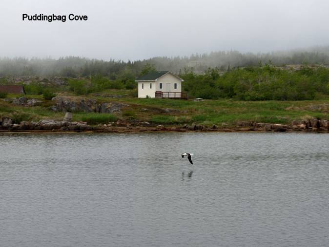
Puddingbag Cove, near Valleyfield. There are no close-by harbours going south from Fogo Island until the northern end of Bonavista Bay, a good 50+ mile run. We began our trip early with light head winds and motored. Within 2 hours the winds had increased in strength and we began motor sail tacking to keep speed reasonable. We passed one grounded ice berg and saw a few further out in the ocean. As we passed Peckford Island in the Wadham Island Group, we saluted Tim Severin’s landing spot in 1977. He is the one who created a replica leather sailboat that the 6th century Celtic monks used, perhaps predecessors to the Vikings in crossing the North Atlantic. At 7PM we anchored in the protected anchorage with a few uninhabited cabins along the shore. At 8PM dense fog rolled in and we could not see the shoreline. For the next 3 days fog banks kept rolling in from the Atlantic, with icy cold damp air that chills to the bone. For Harry Potter fans, fog banks are Death Eaters. We realized that the east coast of Newfoundland has lots of fog and strong southerly winds this time of year; deadly for a pleasure sailboat going south. Rather than dally in the many anchorages in Bonavista Bay, we decided to make tracks as soon as we had a sunny break and make the 30+ mile trip to Bonavista Harbour.
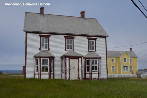
Bonavista Harbour. We began our trip under motor, but soon had enough wind to sail, albeit into the wind. By the time we got to the harbour mid afternoon, the wind had increased to 20 knots. It was a relief to tie up at the floating dock clearly marked “pleasure craft only” with about a dozen fishing boats also moored. Coming into the harbour we saw dense smoke and figured it was a controlled burn or some kind of factory. However, we soon saw a large water bomber flying over the fire, dumping its load of water on the fire, the going over to water to reload. This continued for 2 hours.
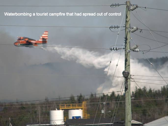
We learned the next day that the fire was at a campground, and the high wind threatened to spread the fire rapidly, so the bomber was summoned.
There is a crab processing plant in Bonavista that was still in operation. Several boats arrived daily. The population of Herring and Ringbill gulls was over a thousand. The gulls appeared to “walk on water” picking crab tidbits off the surface, behavior we have never seen before. We indulged in more than tidbits of crab; 4 snow crabs (8 pounds) fresh off the boat were processed in Pilgrim’s galley.
Springtime comes late in Newfoundland. The last week of June the lilacs were in full bloom and some late-blooming tulips were just beginning to fade. Lupines and wild iris gave colour to the boggy areas.
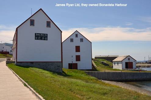
Ryan premises is a Parks Canada museum that re-creates a 19th century fish trading company, much like the one on Battle Island. This museum showed an excellent film about the cod moratorium, giving fair treatment to the many points of view and the effect on the way of life for many Newfoundlanders. It also had displays on the seal hunt, which provides fishers with an “extended season” for creating seasonal income.
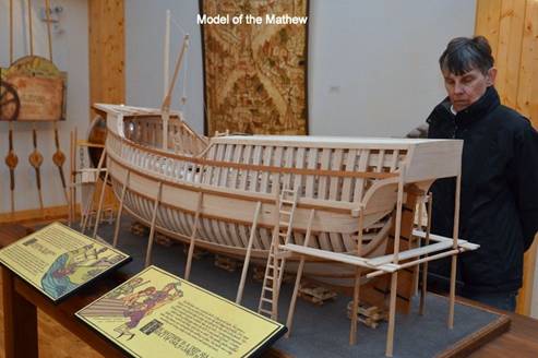
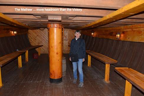
The replica of the Matthew, John Cabot’s boat that landed at Bonavista on June 24, 1597, was less interesting. The replica was not intended to last longer than the 500th anniversary in 1997, and is in such poor condition that it is out of the water, in storage, but still open to the public. The display explaining the boat and the voyage was geared to elementary students, and the guides had few answers to our questions.
Bonavista was “home” for 7 days. The combination of strong southerly winds and fog banks kept us harbour-bound.
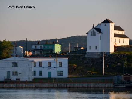
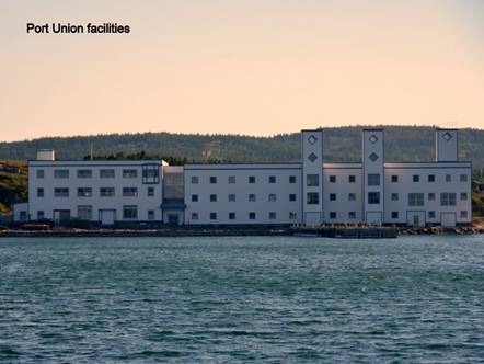
Port Union: We figured if we waited in Bonavista for a weather forecast that was favourable for sailing south, we may have to find winter storage facilities in Newfoundland. The forecast called for fog and SW winds gusting to 35 knots, but the weather in Bonavista harbour appeared to be good (no fog, light winds), so we left to sail around the headland to Port Union, a protected harbour on the east coast of Cape Bonavista. As we rounded the head, the southerly wind hit along with fog banks. The radar was on and the engine helped. Fortunately as we approached the harbour, the fog lifted enough for us to see the shoreline.
Two substantial fishing wharfs with modern processing plants stood empty and closed. Houses dotted the bay’s shoreline. Port Union was established by the Fishermen’s Protective Union (FPU) in the early 20th century, and therefore was influential in the cooperative movement. Perhaps that is why these modern plants have been closed, and the smaller plants in other fishing villages still function. We were anchored in this small town on July 1, Canada Day; we were not surprise when there was no fireworks display after sunset.
We decided that we should make a long run all the way to St. John’s rather than cruise in Trinity Bay. We were learning that between the fog and gusty SW winds, you need to take advantage of every weather window when going down Newfoundland’s east coast.
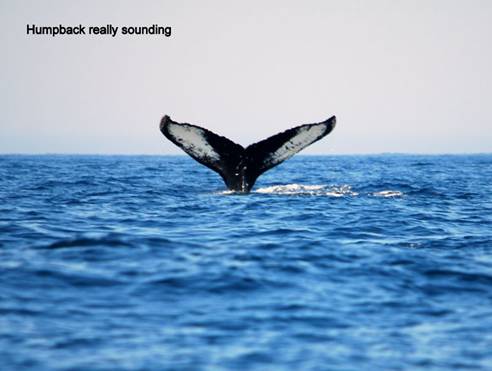
Baccalieu Tickle: In Newfoundland and Labrador, a tickle is a channel, often so narrow and shallow that a dinghy could not pass through it, but sometimes a channel that large boats can find passage. Baccalieu is quite wide and deep, between Baccalieu Island and Bay De Verde, the headland on the south side of the mouth of Trinity Bay. Our cruising guide indicated the tickle could be teeming with marine life: whales and dolphins as well as gannets, puffins, fulmars, razorbills and murres. We were not disappointed. A half dozen humpbacks were traveling northbound, and after we left the passage we were joined by dolphins.
The sail from Port Union to Baccalieu Tickle was in fog and 20 knot winds. The fog lifted as we approached the tickle, and we traveled in sun to St. John’s, but with just 10 knots of wind and 6-foot seas that had not calmed down yet, so the second half of our trip was by motor.
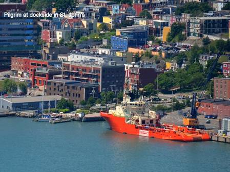
St. John’s: The capital city of Newfoundland is as unfriendly to visiting yachts as Reykjavik, the capital of Iceland. There were two floating docks for visitors (more than in Reykjavik), but they are situated at the head of the “Narrows,” channel into the harbour and therefore uncomfortable with the constant surge from the Atlantic, even in calm conditions. Harbour Authority Traffic gave vague information on where visiting yachts could tie up. There is no water or electricity, and only small park trash bins. There is supposed to be internet along the wharf, but it was not working. There are no public toilets or showers close by. We were presented with a form and rate information ($10/day is reasonable, but a 5-day minimum charge applies) but no indication when the office was open for us to pay our harbour fee. One staff member told us the docks cost the city $8000, but they only made $800 / year. In short, it was not welcoming, especially in a province that is spending a great deal of money on excellent tourism advertising.
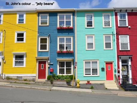
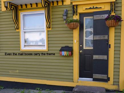
The good news is that the docks were in the heart of downtown St. John’s. The bad news is that most of the businesses and grocery stores are not downtown. There are many restaurants, pubs and tourist shops; vacant buildings and lots with demolished building reminded us of Stralsund, Germany, where destruction from the Second World War still lies waiting reconstruction. We did the walking tours and stopped in at The Rooms, a combination museum, archive and gift shop. The displays we were interested in seeing were in locations other than St. John’s and the gift shop was disappointing, featuring gifts from the Museum of Modern Art in New York City. The Jelly Bean Houses (wooden houses painted and trimmed in bright colours) were a welcome relief from the vacant office buildings, but there is little information about the history of the houses on the English-only walking tour signs.
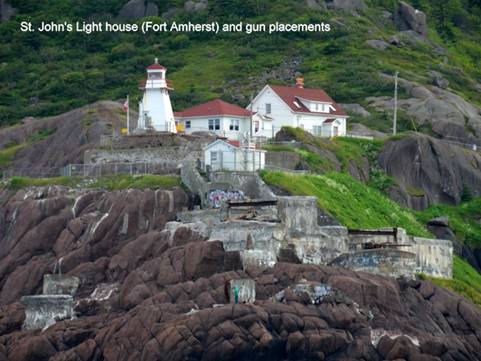
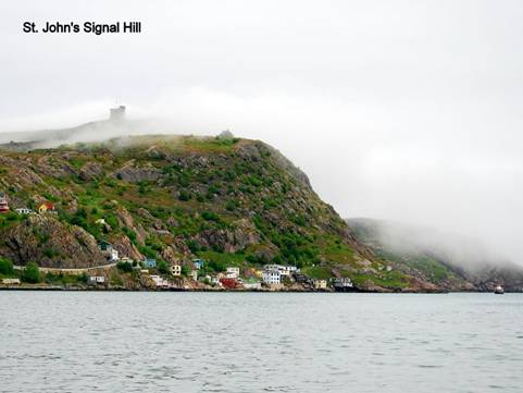
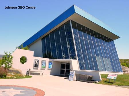
We hiked to Signal Hill overlooking the harbour, with its Cabot Tower. The view was stunning, especially since it was sunny and fog was evident only far on the horizon. The Johnson GEO Centre close by contained some interesting displays (geology, oil & gas exploration, and the Titanic (of course)) and stunning movies.
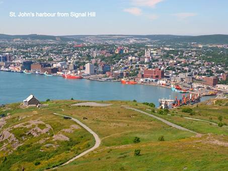
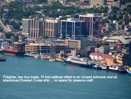
In St. John’s it is abundantly clear that oil & gas has taken over from the cod fishery. The harbour is bustling with supply ships going out to Hibernia. Much of the wharf space is devoted to the supply ships. Other areas that used to be open to visiting yachts are occupied by Coast Guard vessels, cargo ships, tour boats, and a derelict Russian cruise ship that has been abandoned and is listing. The fishing fleet is on the east side of the harbour, with no processing locally. The catch must be trucked to nearby facilities.
Wind, rain and fog kept us at St. John’s for a week. Once again we began to wonder if we would make it off the island before winter.
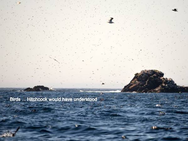
Witless Bay: About 30 miles south of St. John’s there are 4 islands in Witless Bay that are a bird / nature reserve.
We decided to anchor in the bay which gave great protection from southwest winds we were experiencing, but failed to realize we would be the target for the full Atlantic surge from the east. Pilgrim rocked from side to side all evening and through the night, sometimes violently enough to knock one off one’s feet. It was a sleepless night.
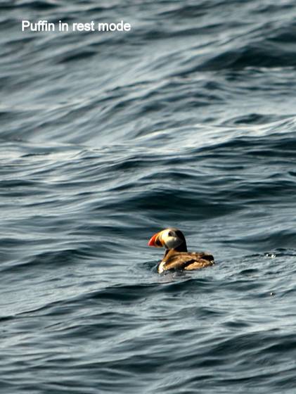
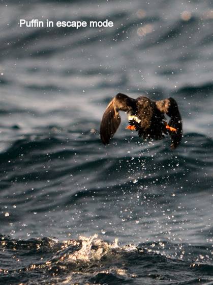
However, the sail through the islands (Great, Green, Gull and Pee Pee) was worth the sleepless night. The puffins in the distance were so thick they looked like a swarm of gnats. The puffins close to the boat put on a show of belly-flops. We even saw humpbacks and dolphins.
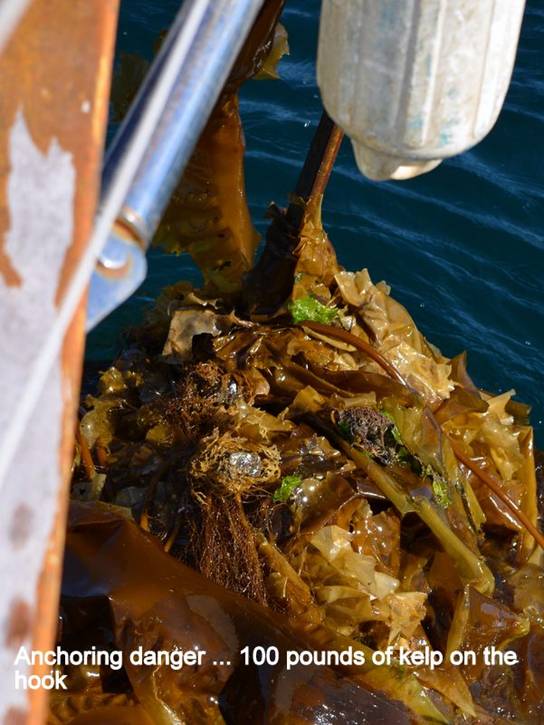
Fermeuse: 30 miles south of Witless Bay there is a long bay running SE/NW with a fishing village at the head. We found a good spot to anchor with no surge and good holding, despite the 18 knot winds from the west and heavy growth of weed and kelp.
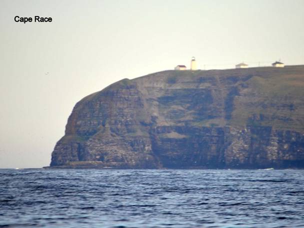
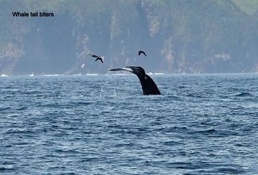
The last leg of our trip down the east coast of Newfoundland would take us around Cape Race, infamous for strong currents and cornering winds that augment the wind speed. The weather forecasts were not promising … southwest winds at 20 knots for the foreseeable future. However, we noted that the wind lessened after sundown, and finally decided to leave Fermeuse late in the afternoon with 20 knots of wind from the south. We had a good sail to Cape Race (southwesterly track) with a display of Humpbacks slapping their flippers on the water. [I know this happened going IN to Fermeuse, not leaving, but it works better for me to mention it here]
At midnight we had to motor-sail around the south coast of the Avalon Peninsula, a slow slug with light winds, but punishing seas. At 2PM the following day we tied up in the tiny fishing harbour of St. Bride’s on the east side of Placentia Bay. Newfoundland’s east coast was now history.