Northern Norway. June 21 – July 27, 2010
Pictures continue to be better at showing what we have experienced in Norway. We encourage you to look at our annotated photo gallery, Northern Norway.
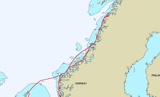
Our track from Bergen to Bodø
June 21-22, Bergen
The inner harbour in Bergen is against a quay with a 3-foot tidal range. The quay is encrusted with mussels and barnacles, so we had fenders, fender balls, and fender boards out to protect us as we rose and fell with the tide.
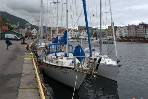
The black tires on the quay walls indicated
that these were at one time for commercial vessels not for pleasure craft
Bergen was established as a hanseatic port by the Germans in the 17th century, and there is a bit of evidence of that influence today. The building material of choice in Norway is wood, which does not preserve well if it survives fires. Therefore most of the charming buildings in the old harbour are recent reconstructions, and help to keep the cruise liners coming to Bergen.
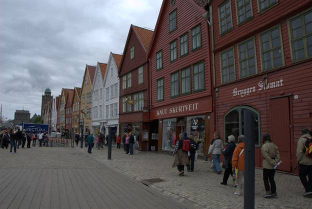
Hanseatic style warehouses catering
to the tourist trade
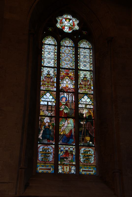
The city centre is definitely tourist-friendly. Lots of folks from the cruise liners stopped by to chat and ask us if we REALLY sailed all the way from Canada. (Few of the Norwegians stop to talk, by the way) After we did our laundry and shopping, we did walk around the old city and found it charming … providing non-Norwegian tourists a good view of old Bergen. The Domkirke (domed church or cathedral) was tiny compared with the red brick Gothic cathedrals in Germany, was built of stone, and not adorned with art. It had beautiful 19th century stained glass windows in the choir.
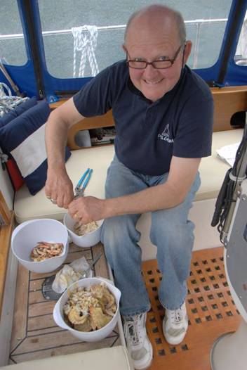
One of the delicacies we found shopping in both the tourist “fish market” booths and in the grocery stores was Fenalår, or salted, air-dried leg of lamb. Sliced very thin, it is like prosciutto, but has a definite lamb taste. MARVELOUS.
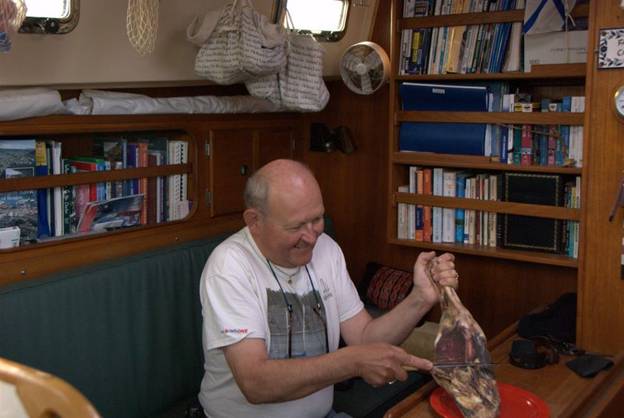
Brian trying to carve a Fenalår
into large tissue thin slices … not as easy as carving smoked salmon
June 23. Uttosavåg
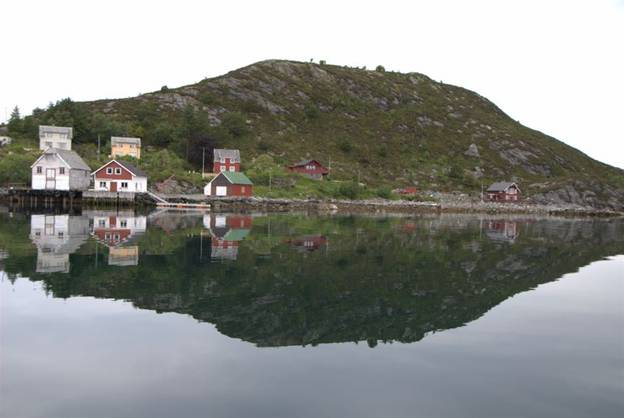
Our first anchorage north of Bergen was remote. We were the only boat in sight, although two other boats were around the corner. There were a couple of huge herons, oystercatchers, cuckoos, gulls and terns, and sheep (moms with bells, and lambs bleating) on the hills. After dinner the light wind died, and the entire anchorage mirrored the rocks, trees and sky. Beautiful. We saw our first white-tailed or golden eagle. We noticed a very large bird that was being chased by gulls, probably because the eagle raided the gulls’ nests.
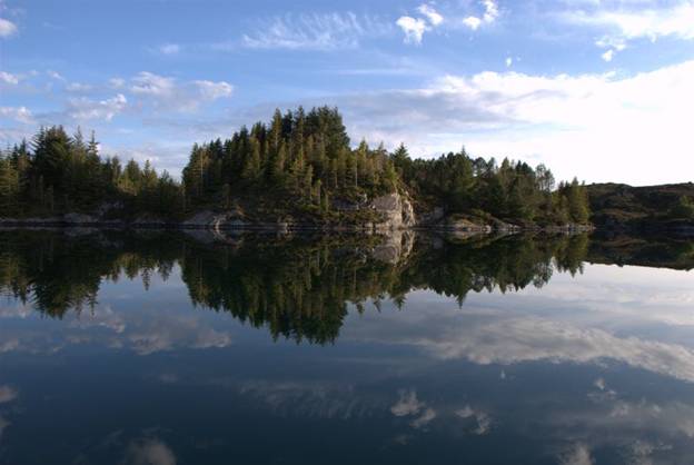
Evening at anchor in Uttosavåg
June 24. Fløholm, at the mouth of the Sognefjord
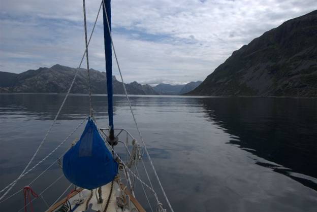
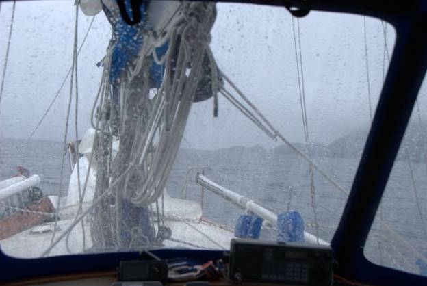
June 24 is the day Norwegians celebrate St. Hans Day (Mid-summer). This is our third midsummer celebration in the Scandinavian countries, and on every midsummer celebration day we have had downpours … not good for lighting the bonfires. The rain has been the least of our harrowing experiences today.
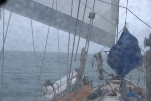
Rain… but at least we have a sail up
We had south winds which allowed us to sail for the first time in weeks. The strong south winds gave us a good sail despite the rain. Our problems began when we entered our first selected anchorage and found it was not shallow enough even close to shore (100 feet deep). We had a secondary anchorage in mind, from Morgan’s Cloud, a US sailboat that has issued an e-book cruising guide for Norway. The anchorage symbol from their book was in a location that looked a bit small to swing at anchor, but there were other options in the vicinity. At 5PM we headed for the entrance. The entrance to the anchorage was so narrow we were almost upon it before we could see it. As we approached Morgan’s Cloud recommended anchorage, we knew it was so tight that with the strong wind, it would be difficult for us to turn around and get out, so we bailed. That is when the excitement began. There was a very strong current running in the narrow entrance, and it was almost impossible to get Pilgrim turned around. We found ourselves going sideways down this narrow channel. Finally we were able to get the bow going down the channel, but the “isolated danger poles” that are used in Norway as navigation aids were on both sides of the narrow channel, and we had to zigzag through the channel. Depths were around 10-15 feet, but suddenly went to 7 and then we ran out of water under our keel. The current swept us off the bottom into clear space. Then we saw the overhead electrical cables, and realized they were only 12 meters high (our mast is 18 meters off the water). We had to turn around, but the channel was so narrow and the current so fast-moving (about 2-2.5 knots) that getting Pilgrim heading back out to sea was nail-biting. Brian took over the helm and Jane called out depths to him as we zigged and zagged our way back out the channel. Despite our efforts, we ended up shy of water under the keel again, this time with the current against us. A little more power from the engine pushed us through. When we finally cleared the channel and got out to sea, Brian checked to ensure we were not taking on water, then we started looking for a third anchorage. We located one that looked OK and it was not too far away. We anchored in 45 feet of water (160 feet of chain out, and a good hold). The wildlife here is cows with cowbells. They watched in amusement / amazement while we anchored.
We were at the mouth of the Sognefjord, the longest and most famous of all the fjords in Norway. However, the visibility with the rain was so poor all we could see were the cows crazing nearby.
June 25. Hærland, Atløy
We docked in a very small town since we could not find a good anchorage. We arrived just before 3PM, tied up at the visitor’s dock, and plugged in. No power. We walked to the fuel dock / restaurant. The man and two teen agers (perhaps new owners of a make-over pub/restaurant and fuel stop) did not know who we should contact to get power, but eventually hollered over to someone who said he could help. The man who opened the electrical panel and flipped the circuit breaker was disinterested in the arrival of a Canadian boat. We seem to be more an annoyance than an interest to Norwegians.
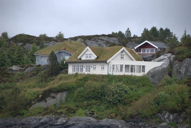
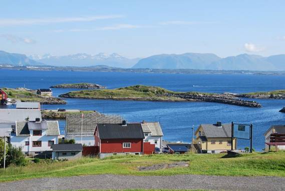
The roofs have a layer of soil and
grass to make them cooler in summer and warmer in winter
Sometime during the early morning hours the harbourmaster turned off the power when he went out fishing. This happened in only one other Norwegian harbor a few days later and made us wonder about service to visiting yachts by Norwegian guest harbours.
June 26. Dombevåg, Hovden, Hellefjorden
At noon we entered a “shoal” area (200 feet deep) that seemed promising for cod-fishing. We drifted for almost an hour and Brian caught a whiting for dinner. A second strike got away. Whiting with Cajun spicing fried in butter is very good.
Dombevåg is a great anchorage. There are houses/cottages on the shoreline, some with sod roofs on the northern exposure. There are a couple of ruins that look like they could have been German WWII buildings / outposts. There are no sheep or cows, and the only birds are squabbling crows and a few gulls. This appears to be a breeding ground for Moon Jellyfish. There are literally thousands of them around our boat. Some are huge, but most are small.
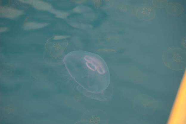
Dombevåg seems to be a
breeding site for Moon Jelly fish
June 27. Silda
It was just another day in Norway with snow-capped mountains, multi-tiered waterfalls, steep-sided fjords, and sea depths that went from 50 feet to 500+ feet within a minute. The mountains have changed shape, and are now jagged peaks. DRAMATIC.
Vågsfjord ... a long day of motoring
toward Silda
It was overcast, and it rained a bit this afternoon. A number of boats are staged at this guest harbor waiting to go around the next major headland hurdle: Stattlandet. Evidently even in calm conditions it “makes its own nasty weather.”
No wind at night, gales or clam in
daylight … hard to sail a sailboat in Norway
June 28. Stattvågen
We left Silda in a dead calm and motored the 15 miles to the headland. While we motored around the headland, Brian cooked up 3 crabs that appeared in his crab trap.
Twenty minutes per crab …
Just as we passed the highest, steepest point of Stattlandet, the storm clouds gathered in the south.
Stattlandet headland … and the clouds
are brewing
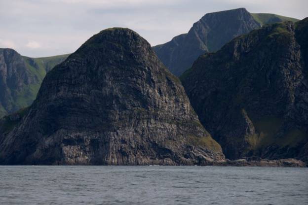
Even though it was only 1PM, we decided to anchor in the harbour of refuge on Stattlandet. There were no other anchorages close at hand, and we did not want to enter a harbour during a storm. Once inside the bay, we found ourselves surrounded by towering cliffs and mountains. We could hear waterfalls and sheep.
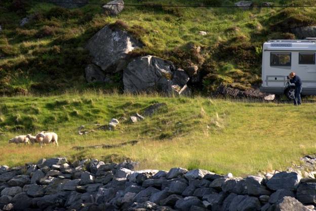
The sheep had a great time toying
with the photographer … she finally gave up and left in frustration
We came through a narrow channel 18 feet deep, but once in the pool, we were in 50 feet of water and even close to shore only found 48 feet. We dropped the anchor and let out 160 feet of chain. Our CQR anchor is very good in mud, and the bottom proved to be solid mud. The high winds may have developed outside the harbour, but we only felt the occasional katabatic wind sweeping down a cliff. The boat pirouetted around the anchor several times. Although there was no wind during our passage, the waves were amazing. There is nothing to interfere with the waves from the southern tip of Greenland until they hit the coast of Norway, so despite no wind, we had waves from the west. The waves hit the steep cliffs and bounce back, so the wave action was confused. In fact, there were small rock islets off the headlands that had waves crashing on ALL sides. Now that is a confused sea.
June 29. Runde
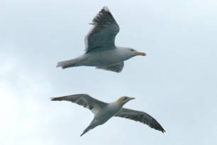
We took an outside route to Runde, and had large rolling swells from two different directions the entire way. We wanted to approach Runde on the NW coast to see the nesting site of thousands of gannets, kittiwakes and puffins. Three miles out, and all we could see were large white splotches on the cliff side. The closer we got the better we could see that these were thousands of birds coming and going off perches on the cliff and inside some shallow caves. The area is incredible, even in the rain, fog and mist. The islands rise out of the water, the mountains are jagged and snow-capped … like mountains a small child might draw. It looked like a setting for Lord of the Rings. Runde has a tourist information centre and café, but the greatest benefit of going to Runde was 6 crabs in the trap.
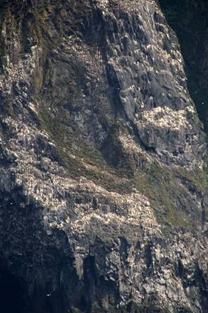
Every white dot is a bird … there are
thousands in this photo … flight paths almost crossing
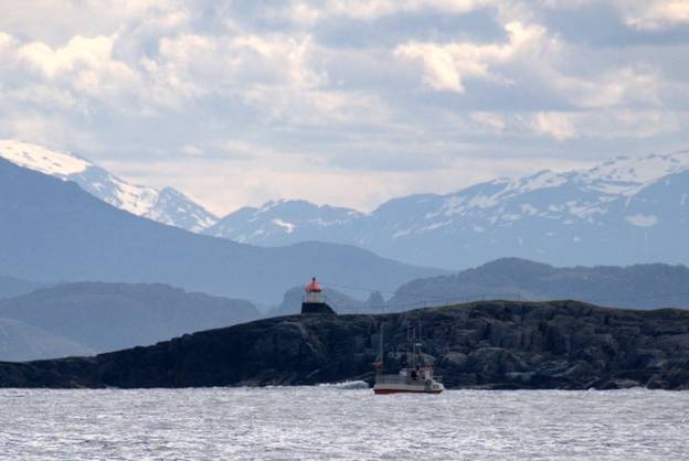
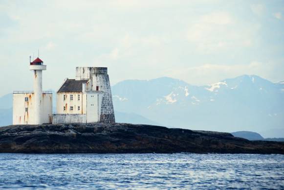
Lighthouse on the NW tip of Runde,
with mainland snow-covered mountains
July 1. Bud
There was NO wind at all, so we motored to Bud. Within a couple of miles of the harbour, we passed over a 60-foot ledge. Brian slowed down the boat and put out a line. Within a minute he had a Whiting on the line. He landed it on the deck and out went the line again. Within another couple of minutes an even larger Whiting was landed on the deck. So one for dinner and another fish in the freezer. Brian is making up for two years of no fish in the Baltic. We also came across a flock of several hundred graylag geese swimming in the shipping channel near one of the low rock archipelagos. The archipelago was probably a nesting spot. In the Oslofjord we saw the graylag families clustered together in communities as well.
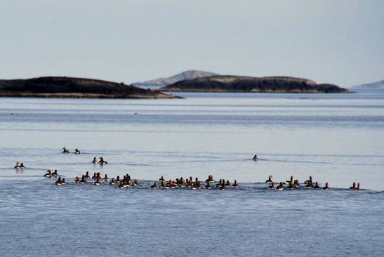
Graylag geese out for a family swim
The harbour has a steep cliff on the north side, and wooden platforms have been attached for the Kittiwakes to perch and nest. There were hundreds of them on the cliff, singing “kit-ty-WAKE” They were fascinating to watch; we wonder why they do not collide in mid-air. An alarm would be silently sounded, and suddenly half the cliff would be in the air, circling together, singing Kit-ty-WAKE.
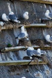
kit-ty-wake cliff and perch detail
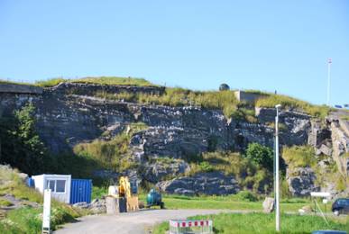
At the top of the cliff was a museum of sorts. The Germans had occupied this space during WWII since it provided a great lookout to a major shipping/ attack channel. There were gun placements, floodlights, and bunkers carved into the cliff. We imagine the entire cliff was a network of tunnels and bunkers in the early 1940’s. The view from the top of the cliff was great. It showed us what is in store for us the next day. The shoreline north is peppered with rock island, islets and shallows.
Navigational challenges to deal with
in the morning
There is a marked channel, but many of the marks are hard to identify … thank goodness for an accurate chart plotter. This passage is exposed in many parts to the open North Sea and its large westerly swell.
July 2. Håholmen, Hustadvika
The weather was calm as we headed out the Hustadvika passage, which can be treacherous in bad weather. There were uncomfortable swells, but nothing scary. About ¾ of the way through the passage we ducked in to Haholmen, a small island that has a conference centre and a few docks. It was developed by Ragnar Thorseth, who built replicas of Viking ships and then sailed one around the world.
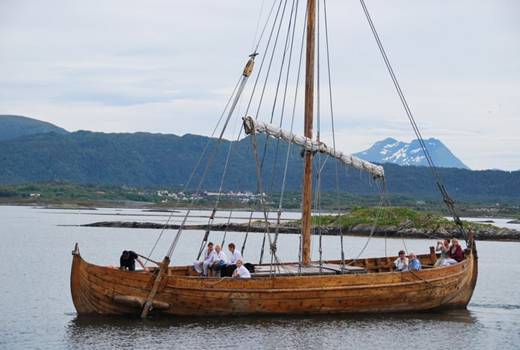
A “replica” Viking ship used to
transport visitors to and from the centre
The boat sank off Spain in 1993, but the wreckage is preserved here. Unfortunately, the building was closed because the video projection system that shows a film of the voyage was not working, so the whole building was locked. The island is lovely, with small huts/houses with sod roofs for visitors who arrive by ferry. There is a restaurant, pub, and small boats (kayaks, rowboats, etc.) for visitors to use. We are sharing a dock with a powerboat (about 30 feet long) with a young couple and their two little sons. Late this afternoon two other sailboats and 2 powerboats and 3 small runabouts arrived, so the docks are pretty full.
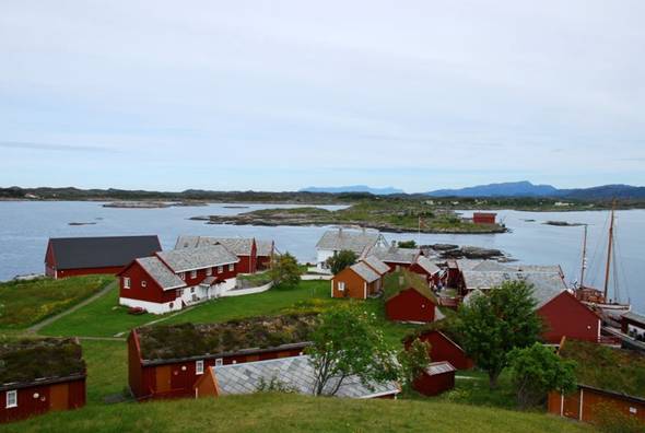
Haholmen
There is a roadway / causeway that connects a number of islands in this area, called the Atlantichavseien, or Atlantic Harbour Road. Our information sources indicate that storms impeded its construction, and in wild weather seas break over the road and the outlying islands. We saw one lighthouse that has a wave protection barrier up to its lantern that looked like it had been thoroughly battered. The weather has not been good for us, but at least it has not been treacherous, as it can be.
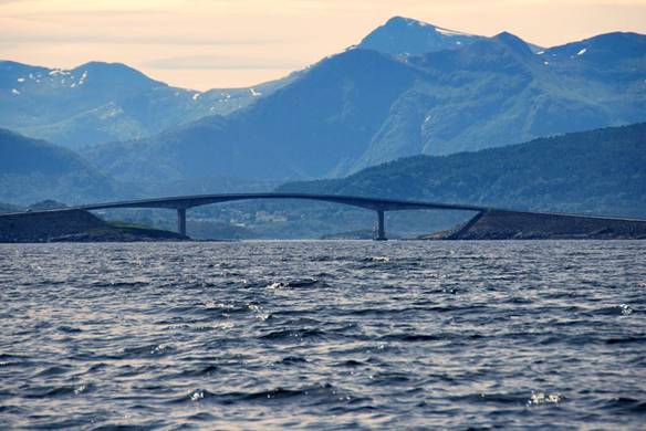
During construction waves were
breaking over the top of the bridge
Lighthouse with a wave barrier
protecting the house and light … yes the waves go over the top
July 3. Kristiansund
We had a short motor trip to this major west-coast city to buy provisions and replacement fishing lures. We had hoped to do laundry, but the doors were locked, and it being the weekend, there was no one to open them. We decided to have a pizza late-lunch at Peppe’s, a very good pizza chain in Norway. We spent $75 for a large pizza and two draft beers. The pizza was good, but it reminded us why we cook our own food onboard.
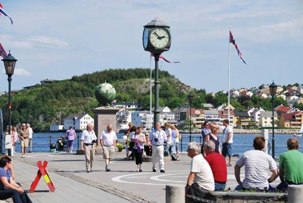
Kristiansund town dock/square
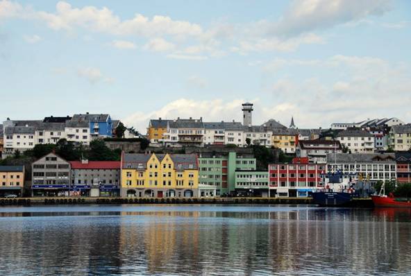
Kristiansund
July 4. Sveholmen, Hemnskjel, Trondsheimleid
Our target anchorage was on the south coast of Hitra, about 50 miles from Kristiansund. The trip was OK. All under motor because we were traveling NE and the wind was NE, between 8 and 14 knots. When we approached our anchorage, documented in our cruising guide and with an anchor symbol on the chart, the area was peppered with fishing buoys and mooring balls. This is the second time we have found an anchorage that the cottage owners have made impossible to use because of floating marks. We checked out an alternative a few miles away and found it was only 42 feet deep. (S/V Pilgrim now has a new standard: any anchorage 50 feet or less is fair game as long as we can deploy 160 feet of chain rode.
July 5. Lysøsund, Tarvafjord
Today was a good demonstration of Norwegian weather. When we left our anchorage it was dead calm. We motored for about 7 miles, and then suddenly had 20-25 knots of wind from the W. We sailed for almost an hour, and then the wind went calm again. We motored. Early in the afternoon a front moved in and brought us 18 knots of wind from the W, so we sailed again, but only for 45 minutes. The wind went calm again. However, we heard gale warnings up to 35 knots from the SW for our area. We ducked into Lysøsund since it is shallow (20 feet) with a mud bottom and well protected from all winds.
Entrance into harbour
July 6. Vingsand, Osen
Today we felt as if we were sailing down a dotted line. Yes, sailing. The gale force winds from the SW moderated to 12-20 knots, and we were able to sail most of the day. Our passage was NE, so we used our downwind sail combination: mizzen and Genoa, and it worked well for us. The dotted line was the weather. On our right side, the land side, it was overcast with gray clouds and mist rising from the mountains. On our left side, the ocean side, it was sunny.
The scenery changes daily. Two days ago the mountains had steep peaks, plunged into the water, but were covered with brilliant green foliage that looked like velvet. Today, the mountains are more rounded and less green. In fact, many of the hills look as if a huge cookie cutter took a round hunk out of the crust … leaving a troll home.
The hills are rounder and starting to
get greener
July 7. Lauvøyvågan, Overgarden, NE of Rørvick
As we approached Rørvik, we saw a somewhat new bird: a black Guillemot. It has bright red feet. This little bird circled our boat at least 6 times, then flew right up near our mainsail, then flew away. Because we have red telltales on the aft edge of the sail, and the sail is white, perhaps the bird thought we were an avian predator or a huge Guillemot. Once s/he had frightened us away from his/her territory, s/he did not return.
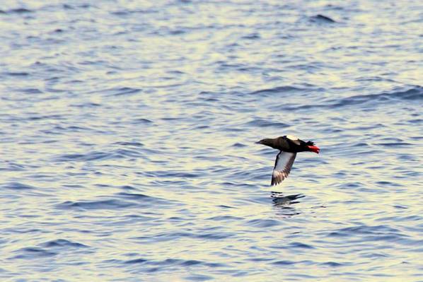
The bird that thought our sail was another
black Guillemot territorial invader
We arrived in Rørvik just after 3PM, located the pontoons for visitors, and could not find any space to land Pilgrim. There was one boat we might have rafted from, but getting in and out would have been difficult. In the end we opted to find this anchorage just NE of Rørvik and forego doing laundry for yet another day. We are in a small bay next to a dairy farm. The cows were quite vocal when we arrived, but now they have been fed, watered and milked and have settled down for the night. We watched a fascinating device pulled by a standard farm tractor wrap bales of hay. The device picked up the bale (cylinder) and had an arm dispense white thin plastic wrap around the bale as two other arms lifted the bale and slowly turned it.
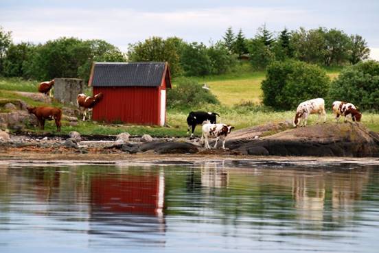
Our anchorage neighbors … not the
party types … just a quiet moo every now and then
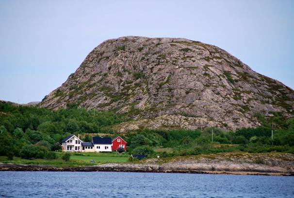
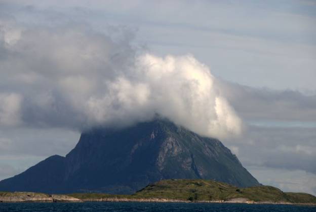
Friday, July 9. Flatøya, Oterholmen
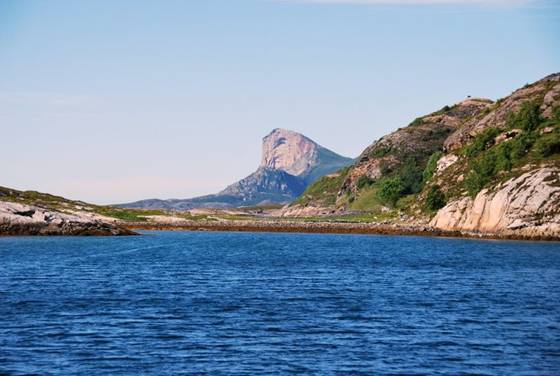
We are anchored in a small archipelago of low-lying islands. The mountains on the surrounding islands and mainland are spectacular. On Alden (island) there are 7 peaks, one for each sister in a Viking legend of a maiden pursued by a troll. The sisters and another girl, Lekamøya, were bathing and discovered by Hestmannen, the horse man. The sisters fled north, but soon became exhausted and dropped down on Alsten island, becoming the 7 peaks on that island (some snow-covered). Lekamøya fed southwards. Hestmannen realized he could not capture Lekamøya and decided to shoot her with an arrow. The king, father of Hestmannen, flung his hat between the two, thus saving the life of the maiden, who reached the island Leka (where we were docked last night). The arrow pierced the king's hat which fell down at Torgar (Torghatten, the mountain with the hole in it), which we passed today. The sun rose, changing everything to stone. The holes in the mountains in this area are caused by erosion of deposits of talc in the rock. Quite dramatic when the talc deposit is large.
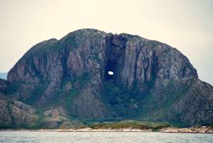
Torghatten and the Seven Sisters (Alsten
island)
Today in this location sunset is at 4 minutes after midnight and the sunrise is at 2:28 AM, so there is no darkness and only 2.5 hours when the sun is not visible. WOW.
Saturday, July 10. Hjartøy
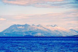
This anchorage has three attractions: scenic views of the mountains (in fog), sea eagles (none sighted yet), and sheep. We have seen the sheep. This site is thought to have been a Viking village, since there are Viking graves here; we have no idea what to look for other than Runes, which are everywhere throughout Norway. It is cold and very wet. However, the next morning when the fog had lifted, the view of the Seven Sister peaks on Alsten was stunning.
Sunday, July 11-12, Hansøya, Regna
The big even was crossing the Arctic Circle at 15:20:37 (3:20 PM). The precise latitude of the circle varies by country (position) and year and is the most southern latitude there is continuous daylight for 24 hours. This year for Norway the latitude is 66 degrees, 33 minutes and 44 seconds North. Had we been here 3 weeks ago, we would have experienced the midnight sun.
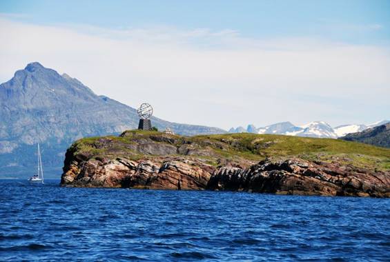
An older Arctic Circle marker … the
actual location is year dependent and north of this location in 2010
This anchorage is another beauty: landlocked with reasonable depth (35 feet). It was still sunny and actually almost warm when we anchored, so we went out in the dinghy to look for mussels and cockles, since the tide was out. We found them, and harvested a few. We have seen the sheep here, but the sea eagles are alluding us again.
mussels and cockles for the taking at this anchorage
Tuesday, July 13-14. Engen, Holandsfjord (Svartisen)
Svartisen, which means black ice, is the second largest glacier in mainland Europe. The ice is actually blue! This is just the tongue … the river of ice that flows from the glacier above to the sea. From our dock it looks as if we could touch the ice, but it is actually a two-hour hike away. The glacier grows and then recedes, then grows again. There is a substantial lake between the dock and the glacier tongue that was covered with ice as recent as 1930. There is also a scientific laboratory underneath the main glacier. The air is quite cool … in the mid to low 50’sF. In addition to the lake and a tourist centre, there are about 100 sheep with bells and bleating. Quite pastoral.
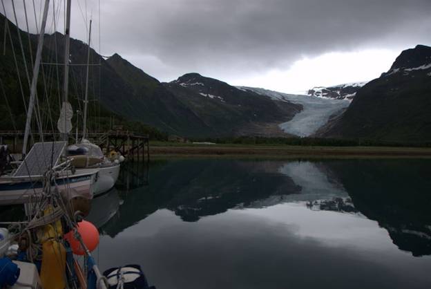
Svartisen at evening light
Our weather was rainy and foggy. On the first day we took the southern trail to the tongue, but became hopelessly lost when the path dissolved in a sea of marshland. The second day we followed a road, and then a trail on the glacier-washed rocks. In the steeper sections and close to the edge of cliffs, there was a handhold made of chain linked through steel posts in the rock. The handhold was mandatory; the rock was slippery with rain and lichens. We passed dramatic waterfalls, sheep (as always), and birch trees that had been pruned of winterkill. The exposed wood was strange to us. It was orange-red, but definitely birch trees. There were also junipers and wild strawberries and blueberries just now in flower. (We also saw lilac bushes in flower still!) The further up the glacier rock we climbed, the less we saw of the tongue since we were on one side of a ridge and it was on the other side. Finally we completely lost our view of it. With Brian’s fear of heights (we were probably about 800 meters above the fjord) and the slippery conditions, we decided to call our ascent off and returned to the road where we had a much better view of the glacier tongue. The entire time it was either raining or misting heavily. We used our cameras with great caution since they are not waterproof.
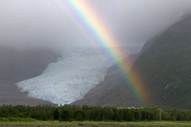
Svartisen in the mist
In the evening there was still heavy mist and fog, but the sun burst through a hole in the clouds, and for a few minutes we had a double rainbow over the glacier tongue.
Thursday, July 15. Støtt
Our plan was to anchor about 10 miles south of Bodø, but when we were in the Støttfjord, traveling NW, the wind increased to 25 knots, and the waves were about 5-6 feet. Our speed dropped to less than 4 knots, and we decided it was best to duck into Støtt, a tiny fishing harbour.
We tied up at the fishing wharf since the guest pontoon was full. It has been quite a while since we had to tie to a fixed dock where there is an 8.5 foot tidal range. At low tide if there were not a ladder on the wharf near us, we could leave the boat. The quay is made of timbers with old black tires attached at various points and a rusted steel ladder. We put our fender boards vertically on the quay and attached fenders horizontally where the fender boards were attached to the quay. But, our fender boards are not 8.5 feet long (the tidal range), so that when we were below the fender boards, there was a possibility of the boards damaging rather than defending our boat. We had to monitor the up and down motion through the night.
Friday, July 16-19. Bodø
We actually had enough wind to sail part of the way to Bodø and kept up with a coaster (small cargo ship that runs coastal routes in Norway). The closer we came to Bodo, the higher the wind speed and the more unfavourable … NE, on the nose. For the last 3 miles we motored head to wind into Bodø harbour. The harbour area is huge, with a small boat harbour, guest pontoons, fishing harbour, extensive ferry docks, and cargo ship quays. Because of its size there is wash / waves, but it is secure.
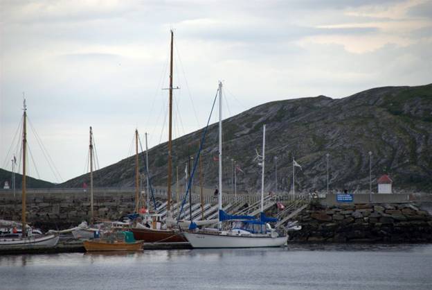
Pligrim at the guest pontoon in Bodø
Bodø was bombed by the Germans in WWII. The Norwegians were trying to buy time and delay signing a pact with Germany. At the 12th hour, the Norwegians capitulated, but two German bombing squadrons had already been deployed. One was successfully recalled, but the other was not. Bodø was one of the towns that suffered the consequences. The town is totally rebuilt after WWII. Little that is old remains. There is a very modern cathedral and enclosed shopping area
Our departure from Bodø was delayed due to a severe SW gale. In the morning the wind was NE at 15-18 knots. The sky looked nasty. We took our laundry into the port service building, and felt a few sprinkles of rain. By the time we got the laundry loaded and the machines running, the wind had clocked 180 degrees to the SW at 20 knots, and the rain was pelting. It was so humid with rain that we had to use two 120 minute cycles to dry our laundry! By the time it was dry (3PM) the rain stopped, but the wind was constant at 30-40 knots. We have been in rough weather, but not in sustained gale force winds like these, lasting 5 hours. Fortunately we are being blown off the dock, but that has challenges when it comes to getting on and off the boat. We doubled up all our lines to ride out the storm. Several local folks walked down to the docks and all commented that this is like Fall and Winter storms. “We never have wind like this in the summer,” they say. (It must be because we are here)
The weather forecasts were discouraging. We decided to stop our northerly travels … (is that why the wind is from the south?) … and start heading for Scotland. We had hoped to get to the Lofoton Islands, but the harbours / anchorages are not that good for a boat our size in bad weather, and there are very strong currents … whirlpools and races …
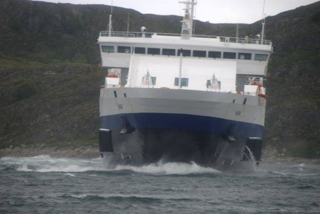
Ferry trying to turn into Bodø
harbour in gale force winds
At the height of the gale, a single-hander in a 40-foot boat arrived in the harbour. He wanted to raft against a boat already secured to the guest pontoon, and found a 38-foot Bavaria sloop that was keen to help. He had to land downwind of the moored boat. The first pass he was blown off before he could even attempt to throw a line. The second pass he got close enough that a young lad could get onto his boat. The third pass the lad threw lines to the receiving boat, and there were a few tense minutes while the lines were secured, and even more minutes while crews tried to haul in the lines to make the boat fast. What a single-hander was doing out in 30-40 knot winds is beyond us, but there seems to be a bit of Viking in most Norwegians still.
The Big Bonus to our delayed departure was that Brian caught a large Whiting off the stern of Pilgrim, enough for 3 meals. It was large enough to require the gaff to bring it aboard safely.
Tuesday, July 20. Nattmalskjeret, near Fugloyfjorden
The wind was still SW, up to 20 knots, and raining. The forecast indicated we would get lighter westerly winds in the afternoon, so we left the dock at 10:45. We battled strong wind and waves from the SW as we attempted to go SW. Finally at 1:30 the wind shifted and we made reasonable progress toward the anchorage we had selected. The excitement came when Brian noticed about 10 large fins surfacing about a quarter of a mile off our stern. Initially he thought they were dolphins, but then realized they were too large to be dolphins. We think it was a pod of 8-10 killer whales which are not uncommon in these waters.
Our first anchorages were not to our liking. The cruising guide said we could anchor in 15-20 feet of water, but we were still in 60 feet and really close to shore, so we began looking for alternatives. We found a guest harbour a couple of miles away, but when we entered it, the boats were already rafted 2-deep. Off to another anchorage. We poked our nose into several bays hoping to find shallow enough water far enough off the shoreline, and finally did find this bay off a small boat channel. We are right under a towering mountain and can here the waterfalls from the boat. There are also sheep with their wind-chime-like bells grazing near the beach. However, although the wind has lightened and gone west, the rain continues.
We hope for sun to dry out the boat. Everything seems damp.
Shelter from the rain and wind
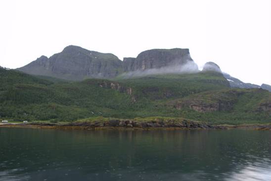
Wednesday, July 21. Hjortøy
This was a long travel day. We left the anchorage at 6:30 and anchored here just after 9PM … 86 miles. We had some good sailing … downwind tacking, with good winds 10-15 knots from the north. Mid afternoon it started to rain, and just when everything was almost dry, everything was doused again. We passed the Svartisen glacier, although we could not see it in the low lying clouds. We passed the mountain-island (Rødøy) that reminded Jane of Marjory, the trash-heap character in Fragle Rock. We passed the anchorage where we harvested mussels and cockels. We crossed the Arctic Circle. For a brief moment when the western skies were clear we saw Lovund, the offshore island that reminds us of the Prudential Rock logo.
The afternoon the rain stifled the wind and brought poor visibility. In the morning many of the mountain tops looked like they were wearing white fluffy hats. Then the ceiling lowered, and they were wearing grey wispy necklaces. Then the ceiling descended to sea level and the shoreline was hardly visible. (…and the forecast said “dry”)
The mountain forces the air up and
over the peak causing the moisture to condense … instant cloud
We were in this anchorage on our way north (July 10). It was foggy then as well. Once again we hope for some dry weather and perhaps even some sun to dry and warm us. The aft cabin is still 55 degrees F.
Rain and fog equal reduced visability
… the norm in Norway
Thursday, July 22. Trælnesodden, Torgfjorden
Last night … last words spoken … “if it is raining in the morning, I’m not getting up.” Well, at 7AM it was raining, but we did get up. The wind wasn’t sure what it wanted to do and where it wanted to go. Just during anchor haul-up, we saw 2 knots and an instant later 17 knots of wind. We motored out of the anchorage, ate breakfast, then unfurled the Genoa with 15 knots of wind from the north … dead aft. With Genoa alone, we were able to make 6 knots, and with a near gale warning in effect, we decided one sail was enough. By 11:00 we had furled the Genoa to half its size and still were traveling 7 knots, surfing at 9. Waves built to about 5 feet. The motor had a needed rest and Jane had a great workout at helm. The rain and low-lying clouds were constant throughout the day. In fact, it was still raining after we anchored. We passed the 7 sister peaks, and Torgethatten, the mountain with a hole in it. But could we see them? NO.
We had time for a bath, but the thought of taking off our clothes, much less soaking ourselves with soapy water, was challenging. Our furnace was going and we were in long woolen underwear, and our warmest sweaters. The shorts are buried so deep in our lockers, we wonder if/when they will ever see the light of day.
Friday, July 23. Fanøya Tarkelholmskjaeran
We awoke to sun! We had one brief shower and saw brilliant rainbow spots where the rain was falling.
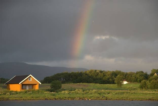
Torgfjorden in the morning rain and
sun
The cabin was still cool, but the cockpit (sunroom) was delightful. We sailed until 11AM when the wind died. Then we motored. Brian had an unsuccessful downrigger out, but this evening at this anchorage in a remote archipelago south of Rørvik he caught two cod. For all the bad weather, at least there has been good fishing after two years of famine in the Baltic.
Sunday, July 25. Myklbust, Harøya
Our 172 mile overnight was a boring success. A success because we managed to make our standard mileage … 172 miles / 34 hours = 5 miles/ hour. Boring because it was entirely under motor. The wind was NE … dead aft, and 4-8 knots, which was not enough to counteract the confused waves of the North Sea. We tried sailing twice when the anemometer showed more than 10 knots, but the Genoa just collapsed with the waves.
About an hour before we got to the anchorage today, Brian
noticed a ledge on the chart, and asked if we could drift over it. As soon as we stopped our forward motion and
drifted with the wind and current, a seagull hovered over us, and landed in the
water. Soon others joined the first, and
we had a fishing-boat group of gulls waiting for the spoils of Brian’s
victory. Brian runs lines with multiple
hooks/lures; his first cast brought up 3 Saithe. A few more and casts and we had 7 on the
stern. The gulls went wild over Brian’s
success. And now our freezer is truly
full of Brian-caught fish. 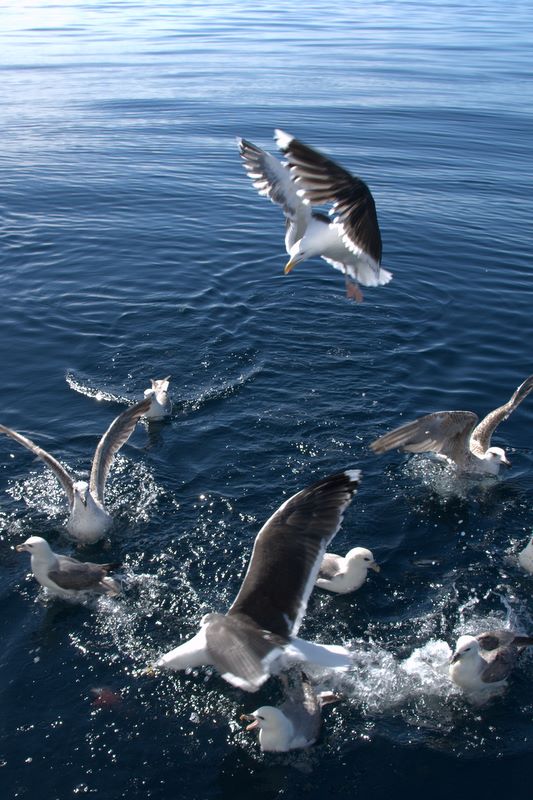
Gulls fighting over bits of fish that
fall off the cleaning table on Pilgrim …
We anchored in calm conditions, but the forecast was for 15 knots from the NE, so we moved to a tiny guest harbour with room for just two boats. There was a Norwegian sailboat on one side of the pontoon, and we occupied the other side. The pontoon is only 38 feet long, so we did overhang slightly.
Tuesday, July 27. Sandhamn, Sandsøy
This was our last stop in Norway where we could fill our empty fuel tanks with Norwegian (tax-free) diesel and prepare the boat for a North Sea crossing. We had a protected anchorage selected in the north of the Shetland Islands … a 200 mile trip.
Brian put out the crab trap for one last attempt, and in just 2 hours we had 4 crabs, which we cooked and picked during our calm North Sea crossing.
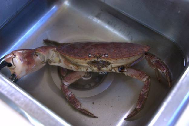
Our last caught crab in Norway … big
enough for two large crab cakes
The trip was relatively easy since there were no breaking seas and the wind was light. We motored the entire trip with mizzen and staysail giving us a bit of a boost now and then. The Queen Mary cruise liner (largest in the world today) crossed five miles in front of our bow, and we saw one cargo ship. Otherwise the only boat traffic was the patrol boats around the drilling rigs in the North Sea … and there are lots of them. We purposefully skirted north of them. Gulls accompanied us almost the entire trip, circling Pilgrim and then settling down for a while. Something about our sails seemed to attract them to investigate us, and we appreciated their company.