General Impressions of Southwest England:
The British do not seem to read, or simply ignore signs they do not want to follow.
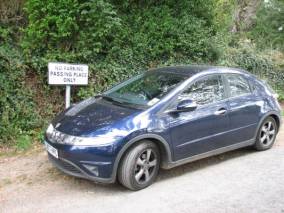
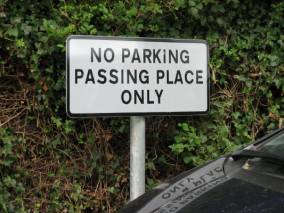
I guess a parked car does get passed … wonder how the driver rationalizes the NO
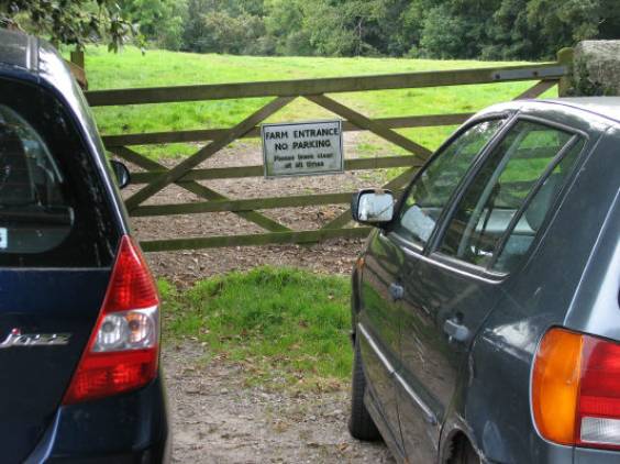
These cars were beside an empty parking lot … there seems to be a thrill in breaking rules
On the other hand, British sailors like to test their right-of-way and often do it when they do not actually have the right-of-way or when it could endanger the give-way boat. Is this just arrogance or are they still suffering the loss of the Empire?
We were surprised to see as much debris floating in the coastal waters on the south shore of England as we did. Paper/ Styrofoam cups and plates, plastic drink bottles, aluminum drink cans, and the occasional plastic bucket were common, despite the strong currents that should have swept them out to sea.
We bought a cell phone SIM card for the UK and thought that ₤30. (about $65.00) would be adequate for the first few weeks. We were shocked when two calls to the US depleted our funds. Vodophone charges ₤1.80 ($3.80) per minute! We found out we could buy an international calling card from the British post office, get a local UK number from them that would connect us to the US network for about ₤0.15/ minute. It is just a bit cumbersome to place the calls. Maybe this is the norm in the rest of Europe.
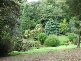
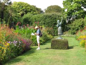
There are many large estate gardens in Cornwall and Devon. Exotic plants that could withstand the mild climate of the south shore of Ireland and England fascinated Victorians. We visited a number of them: Ilnacullin in Glengariff, Ireland, Tresco Abby in the Isles of Scilly, Glendurgan and Trelissick in Cornwall, Overbeck and Greenway in Devon.
Cornwall (August 27-September 10, 2007):
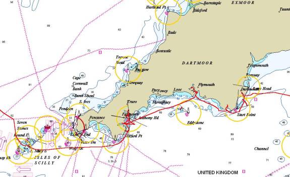
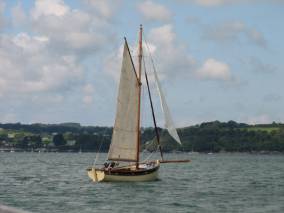
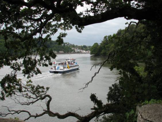
A high-pressure weather system brought sunny weather with light winds for the first 3 weeks we were in England… a nice change after the wet windy weather in Ireland. We sailed from St. Mary’s (Isles of Scilly) to Cornwall on August 27. There was a strong breeze (20 knots from the northeast) when we left in the morning, but by noon the wind had decreased and we motored the last half of the day into the Helford River.
Our
track from Ireland to England via the Scilly Islands
Helford River: The Helford River was our first anchorage on mainland England, and was so delightful we returned twice more for a total of six nights. There is an eelgrass sanctuary near the mouth of the river that used to be a popular anchorage.
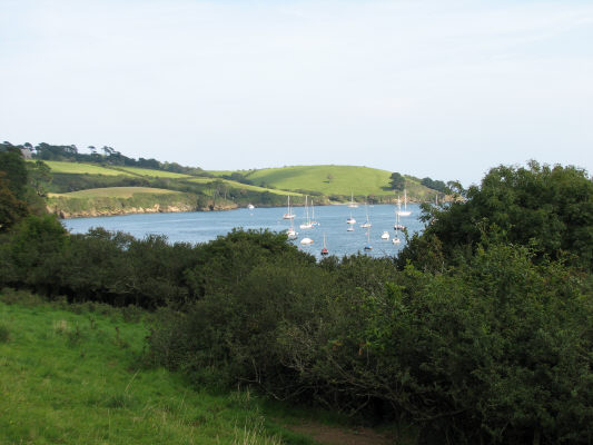
A view of the anchorage from the walking path
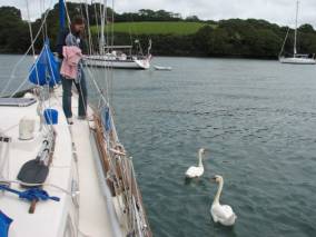
Amelia greeting the guardian swans The local wimp sailing school … 2 hours a day
There was plenty of space outside the sanctuary for anchoring outside two large mooring fields, but the moorings have been expanded near Helford / Helford Passage and so there is no space between the moorings and the oyster beds for boats to anchor upstream. The swells make the anchorage at the mouth of the river a bit uncomfortable, but with a bow and stern anchor keeping the boat into the swells, the yawing motion under control.
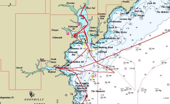
The multiple trips to the Helford and Falmouth shown in red … a very nice place
Our first night in Helford, several hundred barn swallows appeared at dusk and flitted over the water, probably searching for bugs. The air was thick with them for just half an hour. It reminded us of the feeding frenzy the seagulls had on Isle Royale in Lake Superior when the mayflies hatched at dusk.
Durgan is an old fishing village with stone cottages near the mouth of the river on the north shore. Some of the buildings are National Trust property, and a few have been developed into holiday rentals.
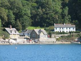
Durgan … a charming old fishing village The Trebah “private” beach
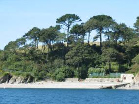
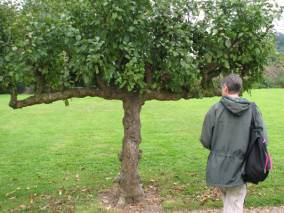
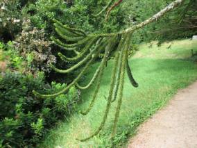
Two large estates are in valleys along the north shore: Trebah (not visited) and Glendurgan. The Fox family still lives in the large house, but the gardens are open. Foxes guard the garden that has been planted since 1820 onwards with exotic subtropical trees and shrubs from around the world.
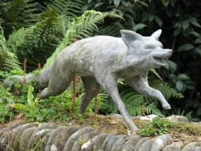
The guardian of the gardens … what a great place to expend all those pub food calories
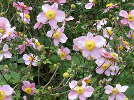
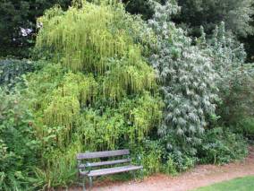
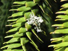
The garden is at its prime in the spring with camellias, magnolias, rhododendrons, azaleas and bulbs, but even in September hydrangeas, amaryllis and cyclamen were in bloom.

The maze was constructed to delight Alfred Fox’s 12 children. It is constructed using Cherry Laurel pruned to about 4 feet in height.
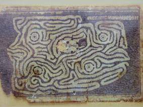
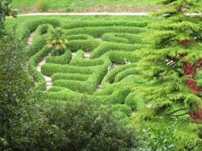
The original maze design and the current reality …participant survival gear not provided
The Giant’s Stride is another feature for children. It is a swing with six ropes hanging from a stout pole. When most of the ropes are taken, children run around the pole, swinging their legs out for a wild ride.
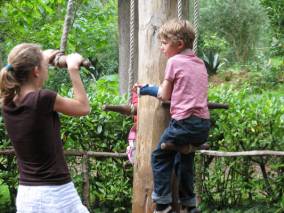
The young fellow had a broken arm and was very unhappy that he had to sit on the handle
Pools, a meandering creek with a bamboo bridge and stands of bamboo grace the valley that runs to the Helford River at Durgan.
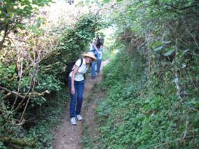
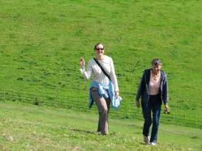
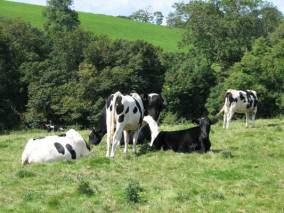
Coastal footpaths are maintained throughout Cornwall and Devon. The footpath on the north side of the river took us through pastures (in which there were cows grazing), over styles on the stone fences, and through turnstiles, past beaches and parish churches. We met and talked with several women who were walking their dogs. The dogs could hardly contain themselves to get to the beach and play fetch in the water. Evidence of World War II is still evident. There was a pillbox on one beach, and the beach where we anchored in Polgwidden Cove was used by the US 29th Infantry Division before they embarked for the assault on Omaha Beach, Normandy in June 1944.
A local vacationer walking her dogs past the estate owned by the National Trust … split into 3 rentals
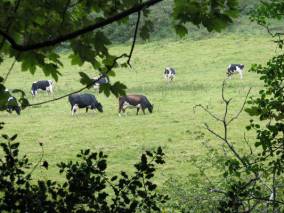
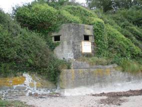
Cows and pies everywhere A WW-II relic “pillbox” guarding the staging beach
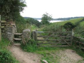
At left is an example of a “style” for getting over a stone fence and the multi mile coastal path
Mawnan Parish Church dates from the 13th century, but St. Maunanus, a Celtic saint, used the site before the current building was constructed. The cemetery surrounding the church includes gravestones that date from the 17th century to modern times, as the church is still in use. The tower includes bells that we could hear on Pilgrim in the Helford River anchorage.
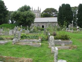
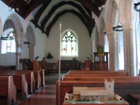
The Mawnan Parish Church exterior and interior … the scale model is a donation box
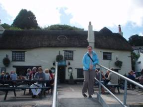
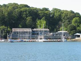
The Helford River Sailing Club welcomed visiting yachts to use their dinghy dock and clubhouse facilities. Helford is s small village of cottages that are mainly used as holiday homes. The Shipwright’s Inn is a delightful pub with a thatch roof and excellent food and drink.
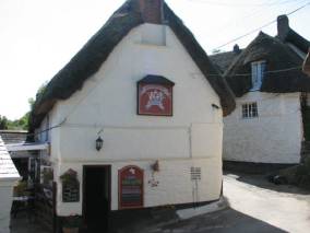
The Helford River Sailing Club dinghy pontoon and a great pub within walking distance
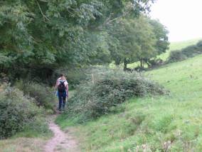
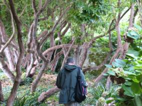
The coastal path along the south bank was very different from the one on the north. It had some very steep inclines and went through a forest that hugged the coastline. Stonewalls lined the path and were covered with ivy, ferns, baby’s tears, and nettles. The forest included many holly, chestnut, oak and maple trees and rhododendron bushes / trees. It would be such a display of colour in the spring.
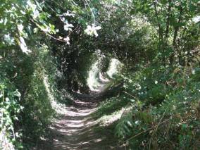
I’m
sure a Hobbit would be at home here but anyone over 5 feet has a problem
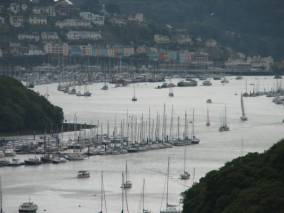
Falmouth and the Fal River Estuary:
Falmouth is a dirty tourist town. The town staff at the Visitor’s Yacht Haven / Falmouth Harbour Control were most unhelpful, actually misleading, when we tried to dock on our first visit. The water around the pontoons is shallow and during spring low tide (that is the lowest low tide during the month) we would go aground, so timing was important for us. Also there is a very crowded mooring field around the pontoons and with a strong wind (20 knots from the northwest), getting to the pontoon dock was a challenge, especially when we could not find any available space even though a radio conversation with the staff confirmed dock availability. After making three attempts at landing (the one boat to which we could have rafted had a “No Rafting” sign posted on its rail), we decided to pick up a visitor’s mooring for the night. The harbour commission charges not only for moorings and docking, but also for anchoring. However, they provide a dinghy dock, showers and coin laundry for the fee. The staff could have freed-up space on the pontoons by asking docked boats to “snug up” to each other, but they just did not care to be helpful in that way. We did eventually get to the dock so we could fill our water tanks and pick up daughter Amelia for a one-week visit.
The best thing we can say about Falmouth is there is a very good laundry service that picked up 3-weeks of dirty clothes at the dock and returned clean clothes 3 hours later. The food and service in the pubs was very poor, the food and fuel were expensive, and the chandlery was expensive and had none of the items on our list. The fact they had no chemical for treating heads / holding tanks spoke volumes about waste management practice in this part of Britain.
We had enough experiences receiving wrong or misleading information to believe the British enjoy being difficult, especially to “colonists.” We were told the Docklands train station was closest to the marina when the Town station was closest. Our daughter was told her train left at 13:27; what was not at all clear was that the train was leaving from Truro, not Falmouth, so she missed her connection and had to buy a second ticket for twice the price to get back to London (she ended up spending almost as much money getting from London to Falmouth as she did getting from the US to London, and considerably more time).
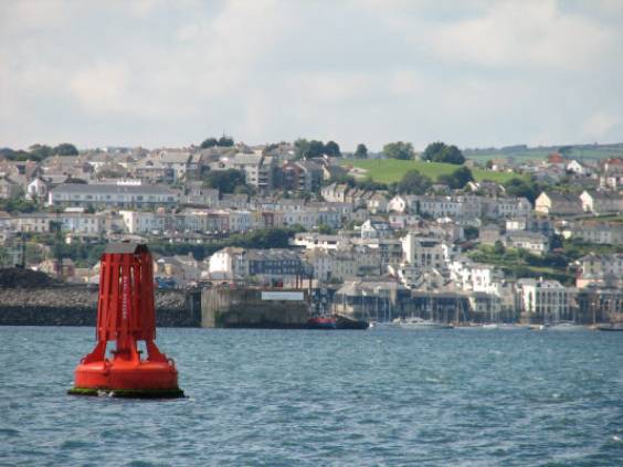
The Falmouth harbour
The docks at Haven were not Heaven There are a lot of old and new gaff rigged boats
As much as we disliked Falmouth, we enjoyed the estuary. We anchored in Channals Creek, about halfway between Falmouth and Truro without any charge. There were “guardian” swans and gulls (birds that greeted and watched over us, mainly waiting for a handout). We saw our first Curlews. Cows were grazing peacefully on the hillside. We saw a seal’s head floating by the boat and realized it was sleeping, until two swans attacked it and it immediately woke and dived.
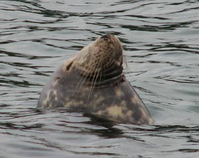
This seal was having a great nap until it got dive-bombed by a pair of swans
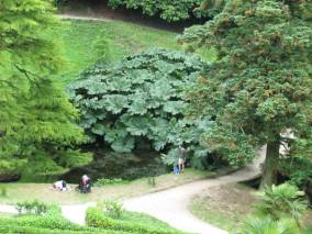
We spent an afternoon in the Trelissick Garden overlooking the river, and had a walk along the coastal path.
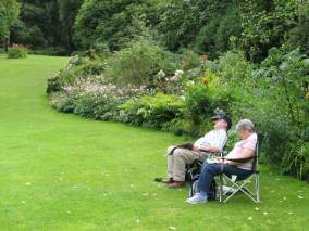
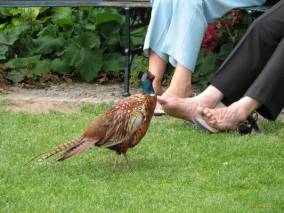
Folks just having a quiet nap in the gardens … but you have to watch out for the toe nibbler
And we are off to see the Moos … watch the pies
Lunch at Pandora’s Inn (another thatched roof establishment) was excellent. The tide went out as we ate our lunch leaving the dinghy barely floating at the end of the dock.
Before Amelia left to go back to work, we had a visit from Hal & Karen, our recently retired ministers and their daughter Kristina, recently married to Todd. They were on their first overseas trip after retirement. We had a delightful afternoon catching up with them and sampling cheese from the Azores, Ireland and Cornwall.
Pandora’s Inn A tearful goodbye at Platform 9
¾
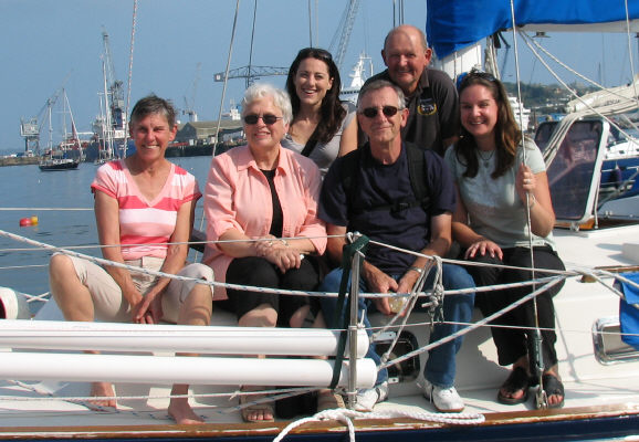
Jane, Karen, Hal, Amelia, Kristina and Brian … taken by Todd
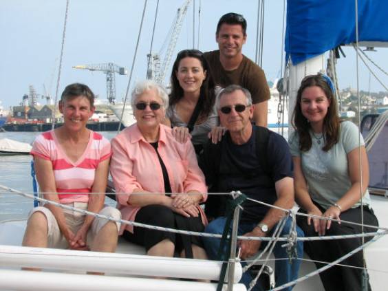
Jane, Karen, Hal, Amelia, Kristina and Todd … taken by Brian
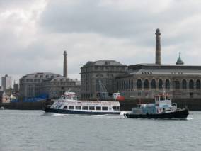
Plymouth:
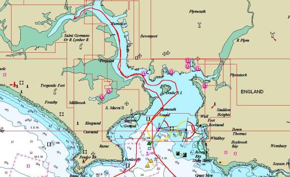
Our route to Plymouth
The light winds persisted and we motored almost the entire way from the Fal Estuary to Plymouth, 40 nautical miles away. This was the first large city in England we visited, but we did not go ashore. As we approached the harbour we noticed bright red-orange cliffs; iron oxide is the cause of this vivid colour.
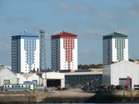
Bright vivid buildings add a touch of “class” to the otherwise drab surroundings
Our first night we anchored in the Barn Pool, between Drake’s Island and Mount Edgcumbe. This is designated as an anchorage in the almanac and charts, but it was an uncomfortable one for us. The water is quite deep (over 40 feet) to within about 500 feet of the shore, and there is a 12-foot tidal range. We anchored in 30 feet of water at high tide, but were very close to shore. We deployed a stern anchor to keep us from drifting further inland with wind or currents. We planned to go ashore to walk around the park and battery ruins, but were uncertain of how well we were anchored.
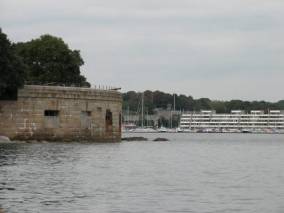
Battlements in front and the very expensive marina behind … lunch break in the park
Another anchorage in the Lynher River upstream the Tamar River looked good as was close to a National Trust garden we wanted to visit.
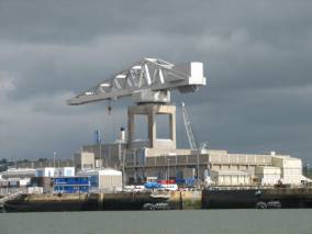
Lots of boats being made ready to go to war … did I miss something in the news?
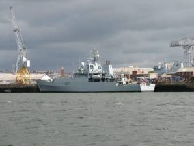
Motoring up the Tamar River was quite an experience. It was our first encounter with British warships, moorings and docks. A warship with the Dutch flag was being towed out to sea as we went upriver. It required two tugs both pulling in opposite directions to maintain control in the fast current. Perhaps it had been refit by the British for the Dutch. We had gone through the rather skimpy Canadian naval yard in Halifax and the rather robust US naval yard in Norfolk. The British was not as big and imposing as the US, but resembled it more than the Canadian scene.
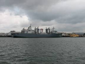
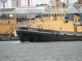
One tug in front and one behind both pulling … Forceful lost and was being pulled backward
The anchorage in the Lynher River was good, but what was not obvious from the chart is that the Jupiter Point Sea Sense Training Centre is situated here. The barbed wire fences led us to believe we should not attempt to land the dinghy. Cadets were zooming about in high-powered Zodiacs, coming as close to Pilgrim as they dared to intimidate us. Our plans to visit Antony, a classical 18th century mansion and garden on the Lynher River were thwarted since we did not feel comfortable leaving Pilgrim and there was no place to land the dinghy.

A Sea Sense school provides training for war A sailing school gaff rigged yawl training for peace
Devon (September 11 - 16, 2007):
Salcombe:
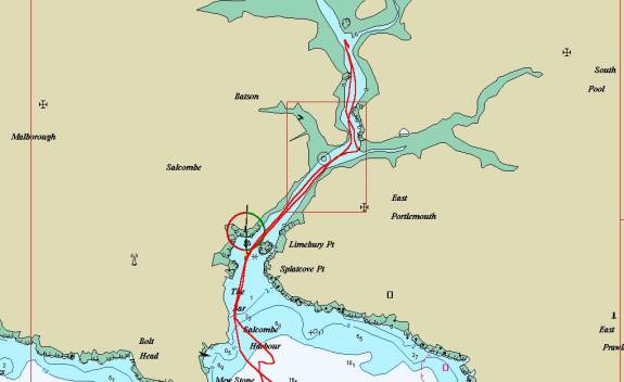
Salcome Harbour
Light winds continued to persist so we motored to Salcombe 30 miles southeast of Plymouth. The entrance to Salcombe is a bit tricky since there is a bar that extends about ¾ of the way across the mouth of the river. We had no difficulty getting into the river, but figuring out how the channel runs through the massive number of moored boats was a challenge, especially since there were boats that were moored to the yellow “fairway” buoys that we think were supposed to mark the safe channel. There were few visible navigation aids to keep us off the shallow banks and drying creeks off the harbour. We anchored at the mouth of the Frogmore Creek, well upstream from the village of Salcombe and upstream from most of the moorings.
The tide is out and boats are stuck in the mud Fuel barge … a common sight in the UK ($2.20/Litre)
A nice quiet countryside anchorage until it was invaded by a bunch of out-of-control preteens
Although there were many boats on moorings, there was only one other sailboat at anchor further up the Frogmore Creek. While we ate dinner enjoyed hearing the church bells being rung at a church in Kingsbridge further up the river.
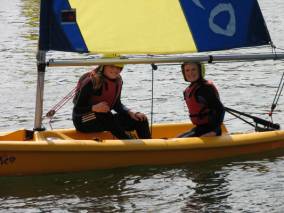
In the morning a group of school children were towed to our area in Pico sailing dinghies. They were wearing wetsuits and crash helmets. There was absolutely no instruction; the kids were undisciplined and unruly and very loud. This was probably a misconceived school program and a far cry from the excellent instruction at the sailing school at the Royal Cork Yacht Club in Ireland.
Salcombe is a charming, but very expensive tourist town. There was a small convenience store and an upscale, pricy butcher shop that advertised wild game, but displayed nothing wild, not even a vicious rabbit.
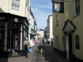
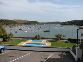
Narrow streets and pedestrians vying for space with cars … A private pool overlooking the harbour
We took our dinghy to the mouth of the harbour and landed it on the beach at South Sands Bay. We were at low water, and the high water mark was about 400 feet across the sand. A boating rental shop kindly lent us a hand trailer so we could haul the dinghy up to safe, dry land while we went ashore.
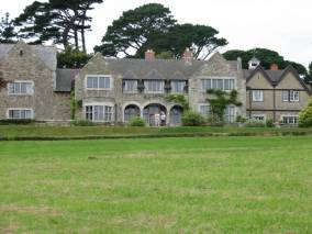
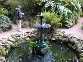
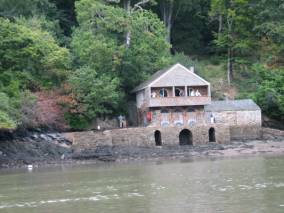
Overbeck’s, a National Trust property that used to be owned by an eccentric inventor, Otto Overbeck, was our first stop. Part of the house and the gardens are open to the public. The house features a large music box, the Polyphon and over 50 metal discs that can still be played on the instrument. There is information and an example of his Electrical Rejuvenator that he patented in 1920. Users of this invention could “defy the ageing process by applying the electrodes from his device to their skin.” There were many pictures and photographs of the maritime life in Salcombe and an extensive collection of stuffed animals and birds, bird eggs, beetles, shells and fossils.
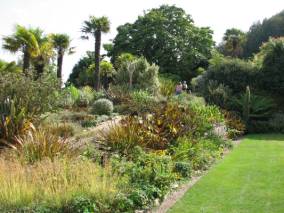

The Gulf Stream provides the warm weather … to grow the representative plants of conquered countries

Impressive house and view and the many gardens are built on terraced land
The first owner of the estate, Edric Hopkins, laid out the gardens in 1901, including walled areas, for tender plants, terraces carved from grey stone and a greenhouse. The view of the harbour from the picnic terrace was magnificent.
We went to the hotel for lunch, a pint and a club sandwich. It costs ₤20. (about $45.) Such are the prices in British seaside tourist towns.
There is a small passenger ferry from town to South Sand Bay. The ferry did not slow down or change course to avoid of flock of 5 swans swimming in the harbour. As the ferry dispersed the flock, and one swan angrily wagged its tail at the ferry. There is a dock for the ferry in town, but none in South Sand Bay. Passengers are loaded / unloaded onto a portable floating dock that is driven by a tractor out into the water and then back up the beach to a platform.
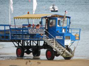
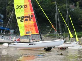
The South Sand Bay portable dock A Hobie Cat on wheels … beats carrying it 200 feet
We had planned to stay a third night in Salcombe, but the harbour master showed up and charged is ₤24. for our two nights at anchor. When I asked what services we received for this fee, he informed us we could get fresh water from the dinghy dock, could land our dinghy, and dispose of our garbage for that fee. Also that the harbour commission had to lease the waterway from Devon and provide navigation aids. He offered me a slick harbour guide with lots of colour photographs, which I refused. I told him we found it offensive to have to pay for the privilege of going ashore to spend our money at the expensive shops and pubs in the village, pay for navigation aids that were invisible, and for a slick advertising booklet. We left immediately for Dartmouth.
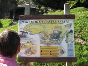
Dartmouth:
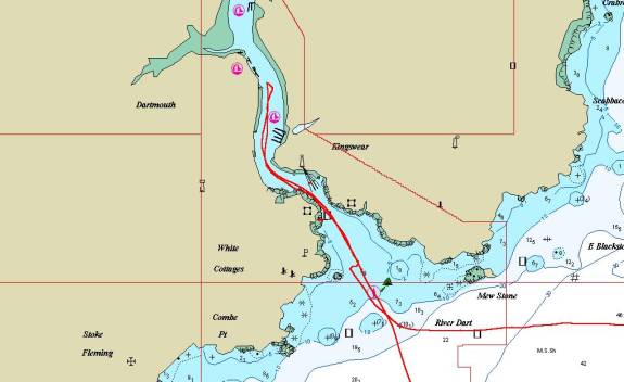
Dartmouth and the Dart River
Because of our sudden departure from Salcome we had not planned our route to Dartmouth to take advantage of the tidal currents. There are a number of headlands along the south coast of England around which the currents can be great, causing races and overfalls, especially if the wind is against the current. We had to go around Start Point and battled the 2-knot current most of the way.
We arrived at the mouth of the Dart River with a 2 knot flood current pushing us along upstream. We were greeted by the harbourmaster who explained our various mooring options and directed us to the visitor’s pontoon without services (water / electricity and no direct connection to land) that was the least expensive and met our needs. The charge was only slightly more that anchoring in Salcombe.
The harbour full of moored boats and the entrance castle
The Dart River is in a valley with steep hills on either side. Dartmouth is on the west and Kingswear is on the east. Both small tourist towns climb up the valley cliffs and are picturesque and colourful. The buildings in Dartmouth are Tudor or Tudor-influenced with 2nd floors overhanging the sidewalk or road. It makes the buildings look like they are on a slant or lopsided.

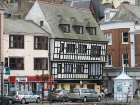
The mix of old and older styles makes the city a Kodak Moment
We had lunch at the Cherub Inn, and authentic Tudor inn complete with thick walls, sagging floors, an open fireplace and very low doorways.
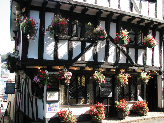
The Cherub Inn … great food in a real pub … at last
The Brittany Royal Naval College sits high atop a hill in a 1909 building. Our first night two helicopters flying low and flying the white British ensign “greeted” us making a huge racket. We though the Brits were above such USA-style flag-waving.
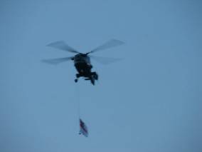
The Brittany Royal Naval College The Brits trying to outdo the Yanks at flag waving
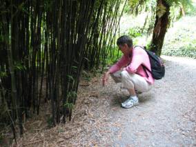
Our first day we took our dinghy up the river to Dittisham where Greenway is located. Greenway is a large estate most recently owned by Agatha Christie and her husband. The house is being restored, so it was not open to us, but the gardens are splendid … better than the gardens we visited at Trelissick, Glendurgan and Overbecks. The estate was quite large, with stables, an all-weather tennis court surrounded by rhododendrons (oh, to be here in the Spring), kitchen gardens, including a large fig tree, a secluded garden with a fountain, many types of ferns and a pet cemetery, many kinds of bamboo and palms, a gigantic monkey puzzle tree (looks like one huge throne bush), fantastic views of the Dart River, and a boathouse that is now a battery (a place that houses bats, that is).
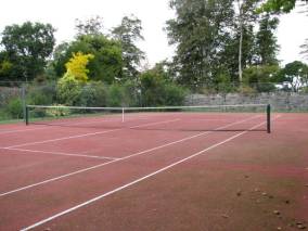
First
all season tennis court in the UK Trees behind the tennis court waiting for an
errant ball
An
apple tree with an attitude Park bench but what’s that
hanging down ?
Pet
cemetery for dogs …hobbies of the rich and famous A growth of Black Bamboo
Monkey
Puzzle tree …why?
and stalk with lichen attached … where are the caribou?
The bath house interior and exterior … now owned by the bats … bath house to bat house … where’s Robin
One
of the many tour boats that ply the river Dart
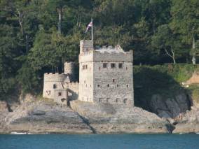
We walked to Dartmouth Castle passing Warfleet Creek. Some folks thought crusader ships left from Warfleet, but this is unlikely. The creek was the site of water mills and lime kilns and is now a trendy holiday home neighborhood.
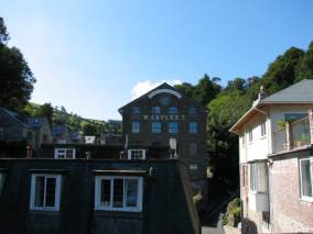
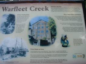
Warfleet
Creek … flour to paper to beer to pottery to condos for the rich …
There are many different parts to Dartmouth Castle, some of them on the east side of the river. In the 18th century a chain was stretched across the river mouth to keep intruders out.

Harbour
access was controlled by a chain strung from this fort to the opposite shore
The entry fee seemed a bit high for touring just one building and a gun tower, so we admired the castle from outside.
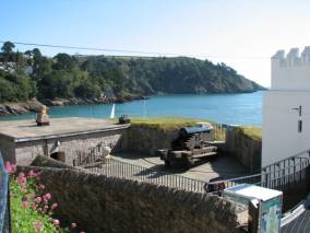
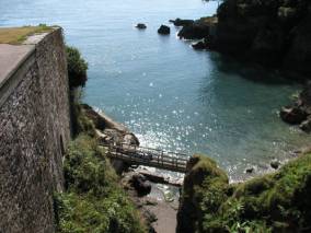
Castle exterior view into the mouth of the Dart
We walked through an ancient forest up a steep embankment towards the Gallant Bower, site of the original earthwork castle, but were uncertain of where the path would lead and how long and high the path was, so gave up before we reached the bower.
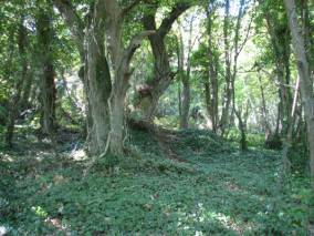
The forest trail that kept going up and up … Jane looking at the map of where the trail really went
We saw the Paignton & Dartmouth Steam Railway train leaving Kingswear with its steam engine and old passenger cars. It looked like a great little ride up to Paignton, but we did not have time to take the trip.
We decided to skip Brixham / Torquay because of limited/no anchorage and Exmouth since the river to Exeter dries and we could not go there with Pilgrim. We hope to visit these towns in the Spring 2008 before we begin our Baltic cruise. As we started looking at charts and tide / current tables we realized we had a problem. The next logical harbour was either Portland or Weymouth. The tip of Portland Island (Portland Bill) has tidal currents that flow down both the west and east side of the headland and merge with the English Channel causing a major race and overflows. The only daylight hours we could safely transverse the are was 10:00 AM (or wait until the high tide was at a later time, which would delay us by over a week). We quickly decided to leave Dartmouth at dusk and make the run to Portland overnight. We had an uneventful motor trip, arriving at Portland Harbour at 10:00 AM.
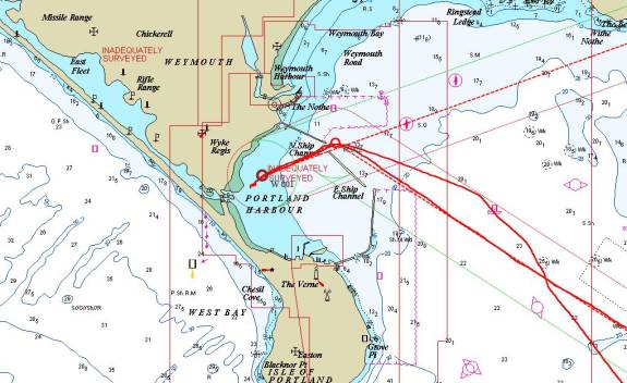
Portland Harbour … largest man-made harbour in the world … 2012 Olympic Sailing Venue
Extreme sports for the military and Olympic types
Our next log file will cover our trip through Dorset and the Isle of Wight.