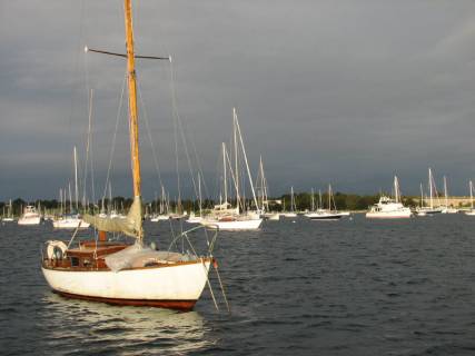
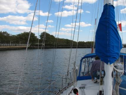
Monday-Tuesday, September 11-12, 2006. Plymouth, Massachusetts. Plymouth provided us a safe mooring while we waited for the tailings of Hurricane Florence to pass the US East Coast. On Tuesday evening, the wind was finally calm. This gave us the opportunity to investigate and fix the jamming problem we had with our Genoa furler and prepare to set off for the next leg of our journey.
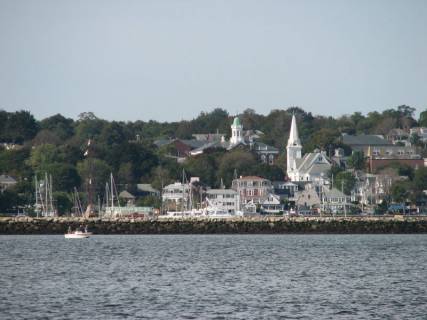
Heading out of Plymouth … city view
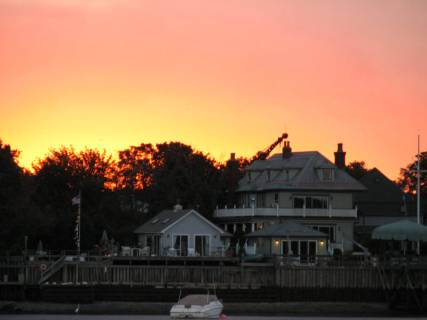
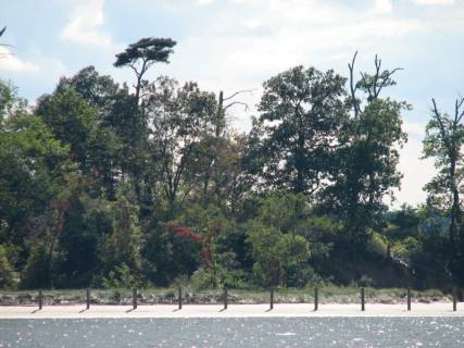
Plymouth Beach … big houses built on sand, and they haven’t fallen down yet
We also received an e-mail from my first boss at the Metro Library. She had read our log from Smith Cove where we were anchored next to Blue Guitar and were wondering which Rock Star owned the boat. She found out! Eric Clapton is the owner (but not on board in Maine). The boat was in Boston Harbor at the end of August; Mr. Clapton was not on board then either. Strange how folks buy expensive, large boats, and then do not spend much time on them.
Wednesday, September 13, 2006. Onset, Massachusetts. We left Plymouth at 9:00 with the end of the ebb tide pushing us out the harbour. We were surprised at how calm the seas appeared to be. There was a 3-4 foot swell that we barely noticed. However, the surf breaking on the beach was spectacular. There was a lot of power in those swells when they hit the beach that we just seemed to float over.
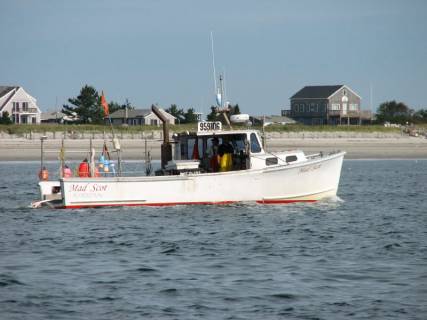
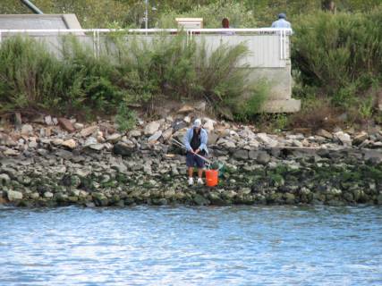
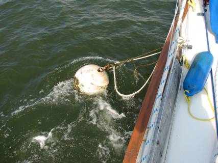
A crabber laying out the prop fouling traps and markers
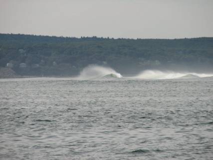
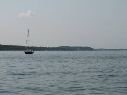
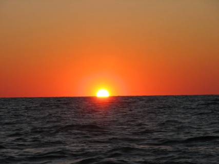
The waves breaking at the entrance to Plymouth
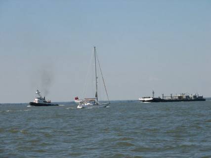
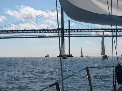
We hoisted the main and then unfurled the Genoa and sailed with a very gentle southwest breeze the 15 miles to the Cape Cod Canal. We were not in a hurry, since we had to wait for the slack time before the ebb tide at 2:30 PM to enter the canal. Because the tidal range on Cape Cod Bay is 10-11 feet and only 4 feet on Buzzard’s Bay, the current in the canal reaches 4-5 knots, and it is important to go with the current. There were about 10-12 sailboats that were in the parade with us down the canal.
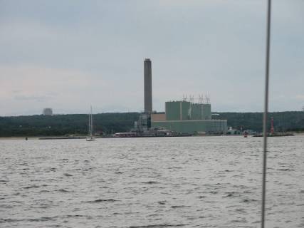
Heading into the canal entrance

Boats to the right of us
Boats to the left of us
And a few spectators to add variety
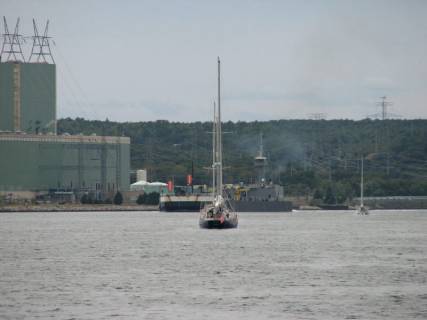
There are two suspension bridges for cars over the canal and a beautiful lift bridge for the train. The lift bridge is open except when a train goes to Cape Cod, which is infrequent.
This bridge has closed when boats have arrived with a 4 knot current pushing them into the bridge. Trains have right of way.
At the west end of the Canal there is a large US Coast Guard Station with a number of boats including a tug.
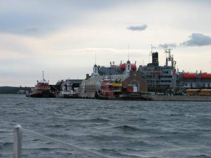
These guys pick up the pieces when the sailboat gets carried under the train bridge
If a boat transversing the canal has engine failure, the tug is dispatched to tow the disabled vessel to a boatyard. Anchoring is not allowed in the canal. Next to the Coast Guard Station is the Massachusetts Maritime Academy (like the Maine Maritime Academy) with a large campus, windmill, and a number of boats including the USS Enterprise.
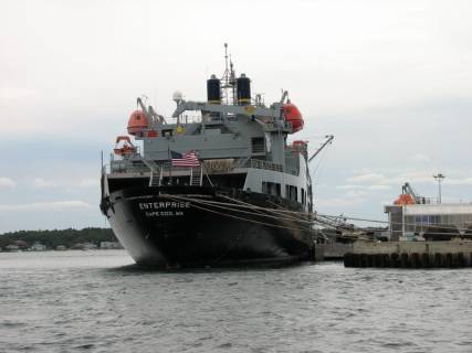
It doesn’t look like a SarShip …
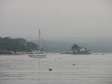
We anchored outside a mooring area at Onset on the south end of the canal. There were about 20+ boats at anchor, having just gone through the canal, or planning to go through the canal tomorrow morning. We met a couple on a boat from Port Hawkesbury on Cape Breton Island who are planning to sail to the Bahamas via the Chesapeake. They have made this trip twice before; it is always good to tag along with someone with experience.
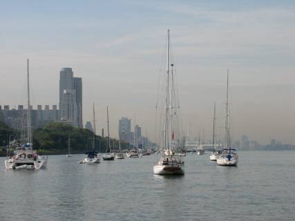
Thursday, September 14, 2006. Newport, Rhode Island. We had a good close reach in 12 – 15 knots of south wind through Buzzards Bay on the southwest coast of Massachusetts. The weather was overcast when we left, and at 1:00 it began to rain. We arrived in Newport around 2:00 and motored around a huge anchoring field chock full of boats trying to find a little bit of real estate on which to drop our anchor. The Newport Boat Show had just opened so perhaps there were more boats here than normal for mid-September. There are very big boats, both sail and power, and some small sailboats that are anchored with no one on board. We saw two old 12 meters sail into the Newport Yacht Club. They are lovely boats … such tall rigs … classic.
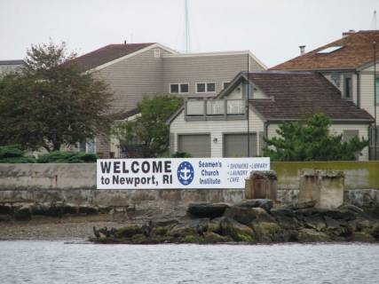
The welcome sign before you see the harbour
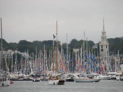
The Newport Harbour … now try and find a place to anchor
We did … right beside this one … and no-one played bumper boats
As we left Newport, a huge Norwegian Lines cruise ship came up the channel to Newport. Golly, those boats are BIG.
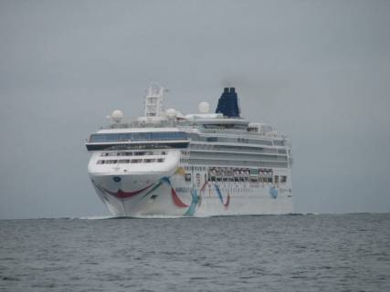
Massive … I can’t believe they expect to anchor in our spot
In Newport, a cannon is fired at sundown as a notice to mariners to “strike colors.” Since we are a Canadian registered boat, flying the Canadian flag, and there is no tradition of putting the flag to bed at sundown, we just leave ours flying. Another cannon blast at 8:00 AM reminds mariners to hoist colors.
Friday, September 15, 2006. Fishers Island, Connecticut. It rained all night in Newport and virtually all day on Friday. The visibility was poor and the big rollers made it difficult to sail.
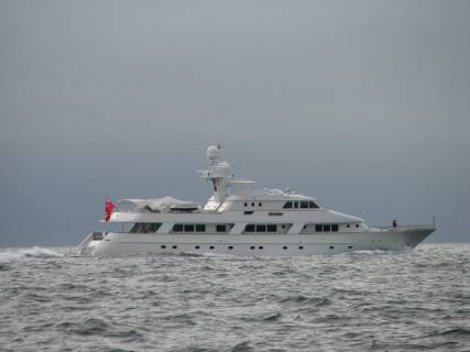
This is about a 120 foot motor boat wallowing in the swell
We decided call a short day and put in to Fisher’s Island, about 20 miles short of the northeast end of Long Island. We were the only boat in the East Harbour. There were two empty mooring balls in the harbour and a golf club on shore. There were actually folks playing golf in the rain when we anchored just before 2:00.
Anchored off the 16th pin
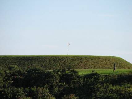
and not a foursome in sight
Saturday, September 16, 2006. Orient Harbor, Long Island Sound, New York. While eating breakfast at Fishers Island, we saw some pure white birds about the size of cormorants sitting on the rocks with the cormorants. It was our first sighting of egrets, which are quite common on Long Island Sound..
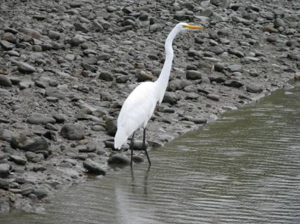
One of the first signs that we are heading south
The sun was shining, but there was little wind and still a major swell so we had to motor all the way to Orient Harbor.
There is a very large outcropping of rock north of Gardiners Island, just east of Long Island. Gardiners Island is a very large, privately owned island that protects the bay between the north and south forks of Long Island from the open Atlantic. This outcropping, called The Ruins, was once connected to the island by a sand spit, which was washed away in a storm, used to have a lighthouse on it (1854) that has been abandoned and disintegrated. During the Spanish-American War a fort was constructed as part of a chain of fortifications aimed at keeping the Spanish from attacking New York. Most recently, it was used as a bombing target. It is a spectacular sight.
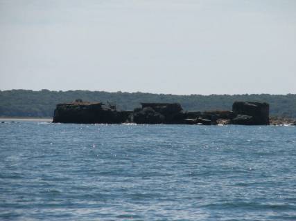
The target or what is left of it
We anchored just off the beach where a childhood friend of Jane’s has a house. She was waving from her front stairs. We took the dinghy off the bow and rowed ashore.
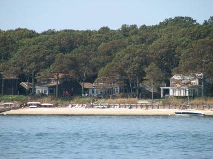
Ellen’s porch from Pilgrim
Pilgrim from Ellen’s porch

The sailboat/powerboat hatred is alive and well in the US of A
Our friend drove us around the North Fork, showing us several wineries, the local marinas, and a fabulous fish shore; it is right on the water and fishing boats pull up to unload their catches. We bought oysters, clams, stripped bass and bluefish. The bass and bluefish were part of a delicious dinner and delightful time with our friend.
Sunday, September 17, 2006. The Thimbles, Connecticut . We had 10 knots of wind from the WSW, so sailed for a little while until we had to turn on the motor so we could get to an anchorage about halfway (30 miles) from Orient Harbor to Westport. There are about 15-20 islands in The Thimbles, studded with very large and elegant cottages. As we anchored, most of the cottage dwellers were returning to their city homes for the workweek. Thank goodness. They were a noisy lot, especially the adjacent cottage; a pipe player serenaded us with the Star Spangled Banner (probably because our Canadian flag is quite prominent.)
The mooring balls are placed to discourage anchoring
The pipe and drum house … at least they could keep time and key
So where is the beach access?
Monday-Tuesday, September 18-19, 2006. Westport, Connecticut. We left the Thimble Islands in a windless haze and motored the 30 miles to Westport. There were a number of freighters both underway and at anchor in Long Island Sound as well as sport fishermen. The Connecticut shoreline is lined with houses, many of them very large. There does not seem to be much shoreline that is undeveloped. The haze kept the visibility somewhat poor so that we were not able to appreciate the scenery along the coastline.

Great food made up for lack of scenery
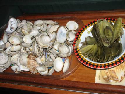
A fine mess of clams, oysters and artichokes … enough to make a walrus proud
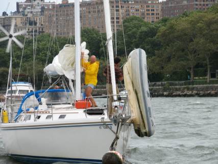
We stayed in a marina in Westport and spent Monday and Tuesday nights with Jane’s daughter, Amelia, who is currently on assignment with Save the Children in their Westport Connecticut headquarters. During the day we used our time at a dock with fresh water to good advantage. Brian devised a “diaper” with line and a garbage bag that he positioned under the speed log so that when he popped out the impeller, the bag diminished the water coming into the boat until he could plug the hole. Sure enough, there were 4 barnacles on the impeller. Once Brian chipped them off, he put the impeller into a glass of water with bleach and a host of “stuff” came out (worms, debris, etc.)
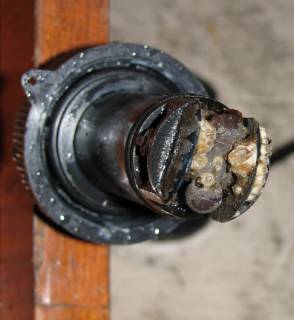
Our first encounter with barnacles
We now have a working speed log again, and feel confident we can take it out for cleaning in the future. Brian also noticed a casualty of salt water in the bilge. A Coke can rusted through and spewed forth its contents in the bilge. Most of our cans and bottles are in plastic boxes; the casualty was not. Everything was removed from the bilge and Brian took our power-washer to it. While he was cleaning the bilge, Jane was working on the decks, which had not been scrubbed since Whitby. When we got to hosing down the cockpit, we flushed out a number of fly carcass’ that had hidden behind lines and cubbyholes. Brian also replaced our exhaust fan for the engine room.
Wednesday, September 20, 2006. City Island, New York. We left Westport at 10:30 AM and tacked up Long Island Sound in a West Northwest wind at 12-15 knots. It was a good sail; we managed to bury the port rail several times, perhaps because we have a full load of fuel and both water tanks are full. The water on Long Island Sound is certainly not inviting. It is a green-brown colour and cloudy. The sound is quite shallow. I don’t think the depth sounder has registered more than 130 feet and most of the trip has been in 30-foot depths.
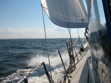
Jane finally burying the rail
We are anchored on the NE side of City Island, in-between it and High Island, which is right in the flight path for planes landing and taking off from LaGuardia Airport (every 1.5 minutes).
This building is a shooting range … open till midnight … what a noise
This one is a bar … open later than the range and noisier
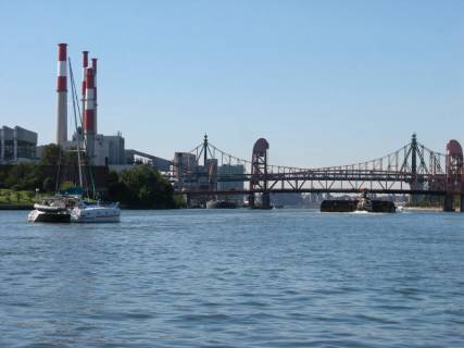
Thursday, September 21, 2006. Liberty Island, New York. What a day to decide to go down the East River! The United Nations General Assembly meeting began, George W. Bush was in town, and so was Stephen Harper (the Canadian Prime Minister for you non-Canadians). There were Police and US Coast Guard boats all over the place, with 50mm machine guns mounted on both bow and stern, and the channel west of Roosevelt Island in the East River was closed since the UN is right on this shoreline. But let me backtrack to earlier in the morning. We left our City Island anchorage just after 8:00 planning to get to Hell Gate (where the East River from Long Island Sound turns south down the east side of Manhattan) at slack before ebb tide to play the currents. We passed under the Throgs Neck Bridge and the Whitestone Bridge without any problems. There were many barges anchored between the two bridges and a tug was depositing another barge in the community of barges. We think they may have been filled with garbage destined for a boat anchored east of City Island and to be dumped out into the Atlantic Ocean (poor ocean). There was one totally rusted out ship half submerged outside the main channel. Then there were the airplanes taking off at a very steep angle from LaGuardia. So many things to watch! At least there were no lobster floats to avoid.
Throgs Neck Bridge

New York skyline with LaGuardia in the forground.
When we got to Rikers Island, just north of LaGuardia, there was a huge barge, 5 stories high anchored on the north shore of the river. We could not figure out what the barge was for until we saw the razor wire. It is a prison, possibly for detainees from LaGuardia Airport. Frightening.
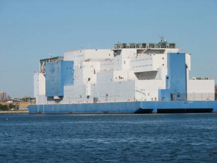
Floating prison … wonder what they do when it gets full?
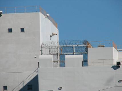
The structure is full of razor wire … no-one is getting out
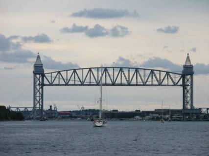
We were doing just fine with a tug/barge fast approaching our stern as we made the turn down Manhattan and saw the flashing blue lights on the Coast Guard boat… and the guns. We came to a halt (as best we could; by this time the current was 2 knots). We were informed the west channel was closed for “military operations.” We change course to go down the east channel. There is a lift bridge from Long Island to Roosevelt Island and it was down. Down clearance was only 35 feet. We had no idea how to contact the bridge. As luck would have it, a large catamaran was coming down the channel and knew to call the bridge on Channel 13. We did a few more circles, let the tug/barge pass us and followed the catamaran down the channel once the bridge opened.
The Roosevelt Island bridge in a down position …
By the time we got to the south end of Manhattan the current was 2.5 knots as we passed under the Brooklyn Bridge.
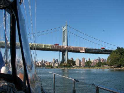
Brooklyn Bridge under wraps
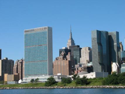
United Nations … the reason we could not go down the west side
When we got to the Battery, we felt assaulted by 3 helicopters landing or taking off, large ferries / water taxis and more Circle Line Tour boats than I thought existed.
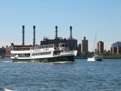
New York harbour is NOT sailboat friendly
Interspersed with these were more Coast Guard boats with machine guns and flashing blue lights. We were glad to get into the Hudson River and over to the Statue of Liberty.
We had planned to anchor between Ellis Island and Liberty Island, but as we carefully picked our way in the “channel” we found depths as low as 6 feet where the chart indicated 13-foot depths. Going aground at the Statue of Liberty did not seem like a good idea, so we backed out and followed a buoyed channel south of the Statue of Liberty to a designated anchorage about ¼ mile west of Liberty Island.

Statue of Liberty … the anchorage is directly behind her
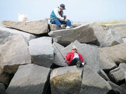
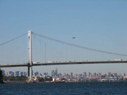
We could not see Manhattan, Ellis Island or the Statue of Liberty from our position in the anchorage. It is out of traffic, very calm and secure, and we could see the Verrazano Narrows Bridge and Staten Island. We watched a man fishing for crabs on the shore and several folks with fishing lines out.
Doesn’t look like New York City
Crabbing in the traditional way
It was hard to comprehend that we were anchored so close to New York City and could not see it. It was similar to Leslie Street Spit in Toronto; so close and yet so far (visually) from the big city. It was also amazing to us that we have traveled more than 2000 miles since Toronto and reached Jane’s university town.
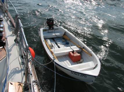
Friday – Saturday, September 22-23, 2006. New York City. We motored up the Hudson to Manhattan’s 79th Street Boat Basin on Friday morning and picked up a mooring ball in the North Mooring field (for sailboats). We discovered that there was not a launch service run by the marina (as was advertised) and the only way we could go ashore was by our own dinghy. We lowered the dinghy and put the motor on it, gathered our laundry and set out for shore. There was one rather pitiful looking shower and the washer and dryer no longer work in the marina. We set out for Broadway to find a laundry and get some lunch. It was about 3:00 when we decided to return to Pilgrim. The ebb current had begun (2.2 knots) causing the boats to point upstream while the strong southwest wind blew and developed a good chop hitting Pilgrim’s transom. We almost swamped the dinghy getting back to Pilgrim; once there we decided to put the dinghy (motor and all) back on the davits rather than tether it beside Pilgrim or stream it behind us. It was impossible to position the dinghy to get the lift lines attached because of the strong current. We finally tied it loosely from three points on the side of Pilgrim. We were bouncing somewhat wildly in Pilgrim and decided it was too dangerous to have any guests aboard. We simply hoped we could get back to shore on Saturday to collect our laundry. We felt like we were under boat-arrest.
79th Street Marina mooring area
At 6:00 PM on Friday, the tide changed and the flood current began. This turned us around so we were pointing downstream and into the wind. It was much more comfortable and we realized we had to time our trip to shore very carefully to match the tidal currents. At 12:30 on Saturday morning, the ebb current took over and turned us around again. The dinghy was most un-behaved and Brian spent the entire night fending off the dinghy and putting the fenders back between Pilgrim and the little boat.
2.5 knots of current
The boat is being pushed by the wind upstream against the current
Saturday we went ashore and appreciated Kris & Erica’s hospitality for showers. At noon we got our laundry and made a beeline for the dinghy and Pilgrim. We got to Pilgrim at slack before ebb and hoped we could get the motor off the dinghy and the dinghy on the bow before the current became too strong. We were successful (and now truly boat-bound). However, as we were securing the dinghy on the bow, we began to swing with the current at a different rate than the boat next to us (no one was onboard the other boat).
We thought we may be dragging our mooring, so quickly turned on the engine and dropped our pennant lines to the mooring. We could not find another mooring ball in the north basin, so we decided to pick up one in the south basin (supposedly for motor boats, but there were already 2-3 sailboats there). We were successful in getting secured to a new mooring, and found the south basin more protected from the waves generated by the southwest wind. By evening the wind died, and we wished we had a way to go back to shore, but taking the dinghy off the bow was too much work.
Our mooring neighbors trying to rescue their inflatable
Sunday, September 24, 2006. Great Kill Harbor, Staten Island, New York. We waited until the wind calmed and threat of rain was over and then motored down the river.
A classic gaff rig schooner
We wanted to get better positioned to make the overnight run down the New Jersey coast, and had planned on spending tonight at Sandy Hook, NJ. It is not a good anchorage in west winds, so we decided to stop at this anchorage on Staten Island instead. We anchored in an opening in a very full mooring field.
Staten Island anchorage area among all of the mooring balls
We discovered that Staten Island was claimed by both New York and New Jersey in the last century. To determine which state would claim the island, a sailboat race was run and New York won.
Tuesday, September 26, 2006. Reedy Island, Delaware River, Delaware. After rain and strong southwest winds on the weekend, Monday dawned sunny with west and northwest winds that were excellent from our south track down the New Jersey coast. We sailed straight through the night and until early this afternoon: 30 hours in total. Of these, we sailed 14 of them in winds 10-18 knots, usually making well over 6 knots of boat speed. There was a parade of 6 boats going down the coast.
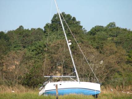
This is what happens when the mooring ball chain breaks
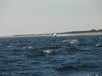
This is what happens when you run out of fuel near a lee shore
There were many pleasure fishing boats drifting or anchored along the coast; the waters were less than 100 feet most of the way and we were more than 4 miles offshore.
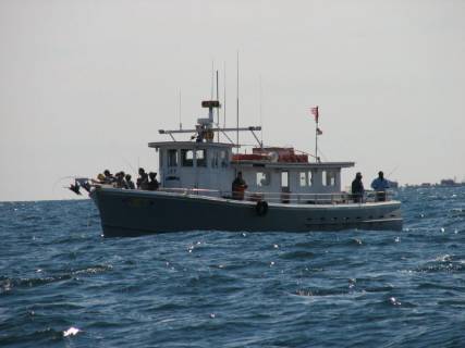
Drift fishing
Brian used the heavy-duty line he bought in Canso with the huge lure our friends who shark-fish gave him (well-scarred) and caught an 8 lb. bluefish. At the time we were sailing on a broad reach doing 6 knots. It took a mighty effort to get the fish to the boat. Landing it on the boat was almost impossible; I tried to blanket the Genoa with the mainsail to reduce our speed to about 4 knots, and luck helped Brian scoop it up in the net and lift it up on the deck.
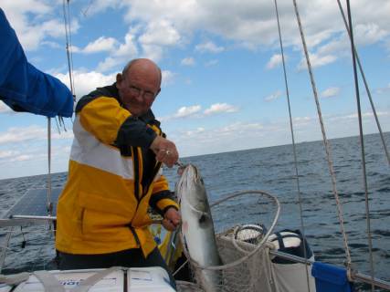
Trolling
We put 3 meals-worth in the freezer and had bluefish instead of our usual Spanish Rice. However, making bread and cooking the fish were a real challenge while Brian was on helm and the rail was almost buried. The oven is gimbaled, but we were heeled over so much that the oven door was hard to open. We were not thrilled with the fish, but I think I did a less than perfect job given the difficult circumstances below.
The amount of pleasure and commercial traffic along the coast was quite amazing. There were both bulk carriers and container ships, but by far the most popular commercial water transportation vehicle is the tug and barge. Tugs pull them, push them, and tow them side-by-side. It is almost impossible to anticipate the path they will take since there are so many different destinations. Some travel less than 5 knots and some go at quite a pace.
Constant traffic day and night
When we were in the Hudson River, we actually saw a rig of 5 barges being pushed by a tug, but actually going backwards with the current; presumably they were marking time until a dock or mooring became available. At night there did not seem to be any consistent way of lighting the barges. In addition to the pleasure fishing boats during the day, there were a number of fishing boats (probably poaching) that were totally unlit after dark.

Now if only these guys would use navigation lights as well as radar
Brian was on watch and almost hit one of them they were so hard to see. After that, we kept radar on all the way down the coast until daybreak.
It is really hard to see an unlit boat at night
Wednesday, September 27, 2006. Bohemia River, Maryland. We both had a sound sleep after our 30-hour sail on Monday/Tuesday. We had a leisurely breakfast since we did not want to leave our anchorage until noon to take advantage of the 2+ knot currents in the Delaware River and the C&D Canal. We were doing boat chores when we heard a horrific siren. We were alarmed because there is a nuclear power station on the New Jersey (north) side of the Delaware River right where we were anchored. Memories of the 9-Mile nuclear power plant disaster flooded back. Should we haul anchor and get out of harm’s way? Should we take the dinghy ashore and hope for ground transportation away from danger? We soon realized the sirens were coming from the Delaware shore, not the power plant. We turned on the VHF radio in case there was some other kind of emergency, but within 10 minutes the sirens stopped. Perhaps just a test. In addition to the test siren, Brian was scanning the radio while fixing breakfast and listened for a few minutes to an “Intelligent Design” evangelical radio station (the Bible is the only source of the truth … and should be followed literally). They broadcast an “alert readiness” test signal, we presume to be used when the end time is upon us.
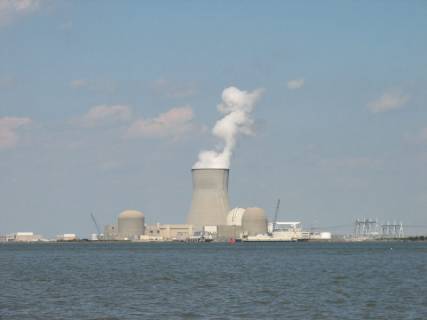
The nuclear plant beside the anchorage
We had an uneventful motoring trip up the river and through the canal. We only encountered one barge going toward the river. We were among about 6-8 sailboats and one trawler going into the Chesapeake. There were a number of high-powered cigarette boats and fishing outboards as well.
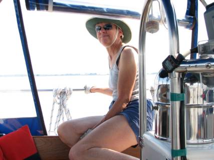
Jane having an easy day at the wheel
The Bohemia River runs East/West and we had a spectacular sunset. The water is warm (71 degrees F) and not too salty. We are hoping for a good hard rain to wash off the Atlantic Ocean salt that sprayed us on our trip down the coast.
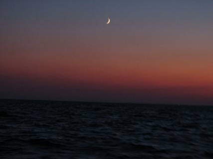
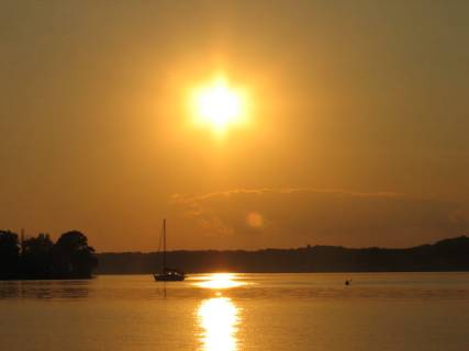
An offshore sunset
Thursday, September 28, 2006. Ordinary Point, Sassafras River, Maryland. Be careful what you hope for. We got the rain. We experienced a torrential downpour, lightning and thunder and gusts above 30 knots, but only for about 20 minutes. We listened to NOAA weather radio for minute-by-minute updates, but they gave information concerning counties rather than islands and points in the Chesapeake, so we felt a bit in the dark. A call to our friend Neil in Washington D.C. helped us understand how the storm was tracking, and that the worst of the storm would pass us to the northwest. Our anchor held beautifully, and the downpour washed off all the Atlantic Ocean salt.
A Bohemia River sunset
“Ordinary” is an old English word for tavern, and long ago there was a tavern and inn on this point of land. The Sassafras River is picturesque. The steep banks on the north side are light copper-coloured sand and mud.
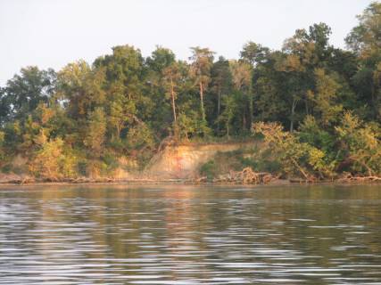
Sassafras River
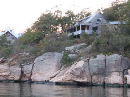
The rolling hills, manicured lawns, horse farms, and mansions make a beautiful backdrop to sailing.
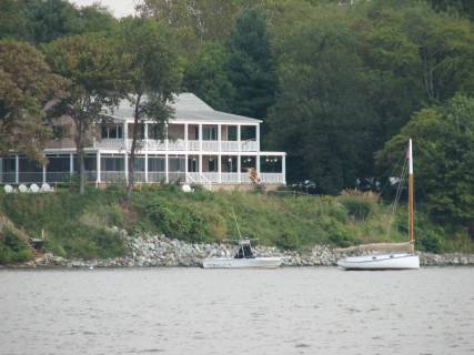
One of the more modest summer homes
At our Sassafras anchorage we encountered a new gull: the laughing gull. Both a ring-bill and several laughing gulls became our “guardian gulls,” which we have missed since the Bras d’Or Lakes. The laughing gull does have a laugh-like cackle.

the laughing gull … it truly lives up to its name
Friday, September 29, 2006. Sillery Bay, Magothy River, Maryland. In the morning the wind had switched to northwest: 10-15 knots with gusts over 20. This was perfect weather for going southwest. We had a reefed main, and a Genoa that started out full, but was half furled by the time we arrived at the anchorage. We can now say we have sailed the Chesapeake and what a sail. We buried the port rail (completely), and new items found themselves on the floor below. The waves were hitting us broadside and were as much a factor in burying the rail as the wind. The depth of the water has averaged 20 feet except in the buoyed channels (40 feet), causing the waves to be fairly steep. Sailing on the Chesapeake is different from the ocean and the Great Lakes. Currents and tides are not great, but the depths make the waves something with which to contend.
We were in a lovely anchorage south of the Patapsco River (on which Baltimore is located at the head) between Dobbins and Little Islands. Judge Dobbins bought Dobbins Island in 1860 mainly for duck hunting.
Dobbins Island complete with No Trespassing signs
which many people tend to ignore
He also bought Little Island, and there is quite a mansion on that island now complete with a pseudo-lighthouse complete with a “glow” from the lantern of the lighthouse. There are synthetic palm trees on the patio next to the lighthouse. Dobbins Island does not have any buildings on it; its shores are steep, but eroding sand/mud.
A light house complete with plastic palm trees … what next
Saturday, September 30, 2006. Dividing Creek, Magothy River, Maryland. We moved up
the river just a few short miles to try our hand at anchoring in a creek.
We motored around Gibson Island then sailed under Genoa up the Magothy River
(about 5 miles) to this creek. As we were trying to figure out where to
anchor among a few mooring balls, someone beckoned from onshore and offered his
mooring ball. The owner came out in his kayak to greet us and recommend
anchorages along the Chester River (our next destination after the Whitby 42
Rendezvous). We found out that the tornado on Thursday night had touched
down briefly in this creek. He said
several houses were damaged and folks had to move out of them
temporarily. Also a number of trees were uprooted.
Dividing Creek and the folks that lent us a mooring ball
Sunday, October 1, 2006. Rhode
River, Maryland. We sailed under
the Bay Bridge, past Annapolis and down to a lovely anchorage in the Rhode
River. The Smithsonian owns much of the
area here and has a number of ecological experiments underway. Thus there are fewer houses / and evidences
of civilization.
Heading for the Bay Bridge with a dozen other
sailboats
There were many sailboats out on the bay today. We had west winds around 10 knots, so it was very good sailing weather. As we passed Annapolis (in the distance) we saw over 100 sailboats.
Our cruising guide suggested anchoring between 3 islands in the Rhode River. When we entered the bend of the river, we could only identify two islands. “High” Island has become a sandbar that disappears at high tide. When it is exposed, it is covered with birds (seagulls, cormorants), and there are no navigation aids. Evidently six years ago it was about 30 feet high.

Flat Island with a doggy run
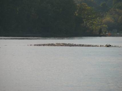
High Island … a fragment of its former self … bird run?
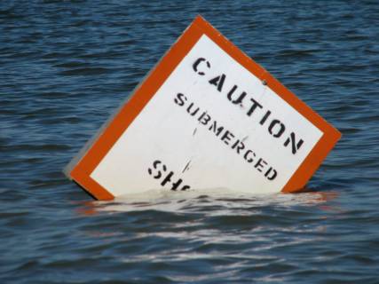
High Island … or rather High Shoal warning sign …
We were in the company of 8 other Whitby 42’s and Brewer 44’s at the Whitby Owners Association Rendezvous at the West River Sailing Club October 3-5. It is great to see other boats and talk with other Whitby sailors about successes, and how we have resolved problems.
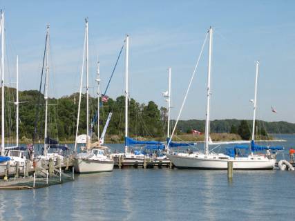
It was great to have so many boats of the same type in one place to inspect
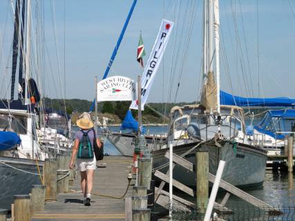
Jane heading back to Pilgrim after a long walk to buy eggs for bread
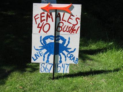
Interesting sign … $40 for a bushel of lively crabby females …
A few general observations about the Chesapeake from our brief time here:
We have found the sun is very intense and warm, while the air is cool and dry … very pleasant. We have been in shorts and T-shirts much of the time. It is like Toronto in August without the mugginess. However, the Chesapeake also knows how to whollop a punch of a storm as we discovered in Sassafras River and in the West River.
We have encountered the Crab pots / floats, but they are not nearly as dense as
the lobster floats in Maine. Also, they generally are out of the buoyed
channels and are relatively well marked.
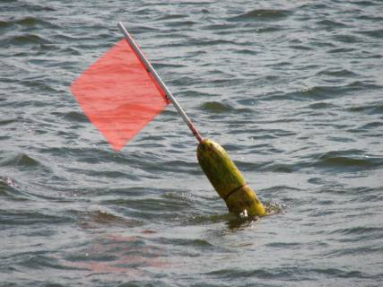
A Maryland Crab pot marker … at least it is visible
We have seen many Monarch butterflies making the migration south, just as we have often seen on Lake Ontario in September. We have also seen and heard our old friends, the Mallard Ducks, just as noisy as in Toronto, and the cackle of Blue Jays in the fall. Jane was delighted to see Sweet Gum Trees, reminiscent of the tree on the lawn of her Dad’s house in St. Louis.
Our immediate plan is to continue cruising in the Chesapeake until the end of October or early November, then work our way down the Intercoastal Waterway and Atlantic Ocean to Florida by the end of December. That trip is another 600 miles added to the 2900 miles we have traveled since May.